
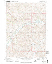
~ Horse Hill WY topo map, 1:24000 scale, 7.5 X 7.5 Minute, Historical, 1970, updated 1973
Horse Hill, Wyoming, USGS topographic map dated 1970.
Includes geographic coordinates (latitude and longitude). This topographic map is suitable for hiking, camping, and exploring, or framing it as a wall map.
Printed on-demand using high resolution imagery, on heavy weight and acid free paper, or alternatively on a variety of synthetic materials.
Topos available on paper, Waterproof, Poly, or Tyvek. Usually shipping rolled, unless combined with other folded maps in one order.
- Product Number: USGS-5612700
- Free digital map download (high-resolution, GeoPDF): Horse Hill, Wyoming (file size: 15 MB)
- Map Size: please refer to the dimensions of the GeoPDF map above
- Weight (paper map): ca. 55 grams
- Map Type: POD USGS Topographic Map
- Map Series: HTMC
- Map Verison: Historical
- Cell ID: 21071
- Scan ID: 339889
- Imprint Year: 1973
- Woodland Tint: Yes
- Visual Version Number: 1
- Aerial Photo Year: 1969
- Field Check Year: 1970
- Datum: NAD27
- Map Projection: Polyconic
- Map published by United States Geological Survey
- Map Language: English
- Scanner Resolution: 600 dpi
- Map Cell Name: Horse Hill
- Grid size: 7.5 X 7.5 Minute
- Date on map: 1970
- Map Scale: 1:24000
- Geographical region: Wyoming, United States
Neighboring Maps:
All neighboring USGS topo maps are available for sale online at a variety of scales.
Spatial coverage:
Topo map Horse Hill, Wyoming, covers the geographical area associated the following places:
- Barr Draw - Kaufman Reservoir - Senff Ditch - Cameron Gulch - Big Draw Reservoir - Sturdevant Ditch - Kaufman Dam - Connley Ditch - Harper Draw - Williams Draw - Spring Draw - Grinnell Ditch - Belus Number 1 Reservoir - Krezelok Mine - Barnes Draw - Sennett Draw - South Fork Harper Draw - Hamilton Draw - Connley Draw - Lower Flying E Ditch - Junk Draw - Big Draw - Snake Hill - Belus Number 2 Reservoir - Irene Reservoir - Fairbanks Draw - Horse Hill - Flying E Creek - Senff Draw - Irene Dam - Maverick Ditch - WJD Ditch - Upper Flying E Ditch
- Map Area ID: AREA44.62544.5-106.75-106.625
- Northwest corner Lat/Long code: USGSNW44.625-106.75
- Northeast corner Lat/Long code: USGSNE44.625-106.625
- Southwest corner Lat/Long code: USGSSW44.5-106.75
- Southeast corner Lat/Long code: USGSSE44.5-106.625
- Northern map edge Latitude: 44.625
- Southern map edge Latitude: 44.5
- Western map edge Longitude: -106.75
- Eastern map edge Longitude: -106.625


