
~ Gros Ventre Junction WY topo map, 1:24000 scale, 7.5 X 7.5 Minute, Historical, 1968, updated 1973
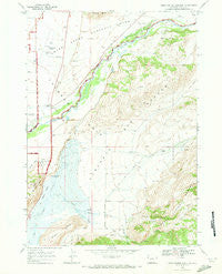
Gros Ventre Junction, Wyoming, USGS topographic map dated 1968.
Includes geographic coordinates (latitude and longitude). This topographic map is suitable for hiking, camping, and exploring, or framing it as a wall map.
Printed on-demand using high resolution imagery, on heavy weight and acid free paper, or alternatively on a variety of synthetic materials.
Topos available on paper, Waterproof, Poly, or Tyvek. Usually shipping rolled, unless combined with other folded maps in one order.
- Product Number: USGS-5612374
- Free digital map download (high-resolution, GeoPDF): Gros Ventre Junction, Wyoming (file size: 10 MB)
- Map Size: please refer to the dimensions of the GeoPDF map above
- Weight (paper map): ca. 55 grams
- Map Type: POD USGS Topographic Map
- Map Series: HTMC
- Map Verison: Historical
- Cell ID: 18619
- Scan ID: 339727
- Imprint Year: 1973
- Woodland Tint: Yes
- Aerial Photo Year: 1967
- Field Check Year: 1968
- Datum: NAD27
- Map Projection: Polyconic
- Map published by United States Geological Survey
- Map Language: English
- Scanner Resolution: 600 dpi
- Map Cell Name: Gros Ventre Junction
- Grid size: 7.5 X 7.5 Minute
- Date on map: 1968
- Map Scale: 1:24000
- Geographical region: Wyoming, United States
Neighboring Maps:
All neighboring USGS topo maps are available for sale online at a variety of scales.
Spatial coverage:
Topo map Gros Ventre Junction, Wyoming, covers the geographical area associated the following places:
- Sleeping Indian Pond - Gros Ventre Campground - Sheep Creek - Long Hollow - Jackson Hole Airport Fire Department - Warm Springs Ranch - Jackson Hole Airport - Twin Creek Ranch - Elk Exhibition Pasture - South Twin Creek - North Twin Creek - National Elk Refuge - Curtis Canyon Campground - Abercrombie Warm Springs - Millers Butte - Nowlin Creek - Kelly Post Office - Kelly Census Designated Place - Jackson National Fish Hatchery - Curtis Canyon Overlook - Peterson Springs - National Museum of Wildlife Art of the United States - Gros Ventre Junction - Curtis Canyon
- Map Area ID: AREA43.62543.5-110.75-110.625
- Northwest corner Lat/Long code: USGSNW43.625-110.75
- Northeast corner Lat/Long code: USGSNE43.625-110.625
- Southwest corner Lat/Long code: USGSSW43.5-110.75
- Southeast corner Lat/Long code: USGSSE43.5-110.625
- Northern map edge Latitude: 43.625
- Southern map edge Latitude: 43.5
- Western map edge Longitude: -110.75
- Eastern map edge Longitude: -110.625


