
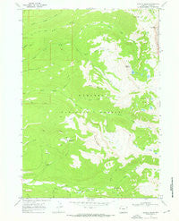
~ Granite Basin WY topo map, 1:24000 scale, 7.5 X 7.5 Minute, Historical, 1968, updated 1972
Granite Basin, Wyoming, USGS topographic map dated 1968.
Includes geographic coordinates (latitude and longitude). This topographic map is suitable for hiking, camping, and exploring, or framing it as a wall map.
Printed on-demand using high resolution imagery, on heavy weight and acid free paper, or alternatively on a variety of synthetic materials.
Topos available on paper, Waterproof, Poly, or Tyvek. Usually shipping rolled, unless combined with other folded maps in one order.
- Product Number: USGS-5612268
- Free digital map download (high-resolution, GeoPDF): Granite Basin, Wyoming (file size: 10 MB)
- Map Size: please refer to the dimensions of the GeoPDF map above
- Weight (paper map): ca. 55 grams
- Map Type: POD USGS Topographic Map
- Map Series: HTMC
- Map Verison: Historical
- Cell ID: 18057
- Scan ID: 339675
- Imprint Year: 1972
- Woodland Tint: Yes
- Aerial Photo Year: 1967
- Field Check Year: 1968
- Datum: NAD27
- Map Projection: Polyconic
- Map published by United States Geological Survey
- Map Language: English
- Scanner Resolution: 600 dpi
- Map Cell Name: Granite Basin
- Grid size: 7.5 X 7.5 Minute
- Date on map: 1968
- Map Scale: 1:24000
- Geographical region: Wyoming, United States
Neighboring Maps:
All neighboring USGS topo maps are available for sale online at a variety of scales.
Spatial coverage:
Topo map Granite Basin, Wyoming, covers the geographical area associated the following places:
- Beaver Creek - Granite Basin Lakes - North Leigh Creek Trail - Beard Mountain - Granite Basin - Ricks Basin - South Leigh Creek Trail - Bear Canyon - South Leigh Lakes - Grand Targhee Resort - Mill Creek - Green Mountain Trail - Treasure Mountain Camp - Jedediah Smith Wilderness - Dry Creek Basin - Green Mountain - Teton Campground - South Fork Teton Creek - Alta Division - Freds Mountain - Crows Nest - North Fork Teton Creek - Miles Creek - Green Lake - Andy Stone Creek - Tin Cup Creek - Teton Range - Andy Stone Trail - Eddington Canyon - Green Lakes Mountain - Treasure Lake
- Map Area ID: AREA43.87543.75-111-110.875
- Northwest corner Lat/Long code: USGSNW43.875-111
- Northeast corner Lat/Long code: USGSNE43.875-110.875
- Southwest corner Lat/Long code: USGSSW43.75-111
- Southeast corner Lat/Long code: USGSSE43.75-110.875
- Northern map edge Latitude: 43.875
- Southern map edge Latitude: 43.75
- Western map edge Longitude: -111
- Eastern map edge Longitude: -110.875


