
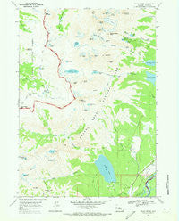
~ Grand Teton WY topo map, 1:24000 scale, 7.5 X 7.5 Minute, Historical, 1968, updated 1973
Grand Teton, Wyoming, USGS topographic map dated 1968.
Includes geographic coordinates (latitude and longitude). This topographic map is suitable for hiking, camping, and exploring, or framing it as a wall map.
Printed on-demand using high resolution imagery, on heavy weight and acid free paper, or alternatively on a variety of synthetic materials.
Topos available on paper, Waterproof, Poly, or Tyvek. Usually shipping rolled, unless combined with other folded maps in one order.
- Product Number: USGS-5612258
- Free digital map download (high-resolution, GeoPDF): Grand Teton, Wyoming (file size: 10 MB)
- Map Size: please refer to the dimensions of the GeoPDF map above
- Weight (paper map): ca. 55 grams
- Map Type: POD USGS Topographic Map
- Map Series: HTMC
- Map Verison: Historical
- Cell ID: 18004
- Scan ID: 339668
- Imprint Year: 1973
- Woodland Tint: Yes
- Visual Version Number: 1
- Aerial Photo Year: 1967
- Field Check Year: 1968
- Datum: NAD27
- Map Projection: Polyconic
- Map published by United States Geological Survey
- Map Language: English
- Scanner Resolution: 600 dpi
- Map Cell Name: Grand Teton
- Grid size: 7.5 X 7.5 Minute
- Date on map: 1968
- Map Scale: 1:24000
- Geographical region: Wyoming, United States
Neighboring Maps:
All neighboring USGS topo maps are available for sale online at a variety of scales.
Spatial coverage:
Topo map Grand Teton, Wyoming, covers the geographical area associated the following places:
- Mount Hunt Divide - Bradley Lake - The Wall - Teton Glacier - J Y Ranch - Teewinot Mountain - Mount Hunt - Timberline Lake - Teepe Pillar - Teepe Glacier - Shoshoko Falls - South Fork Avalanche Canyon - Open Canyon Trail - Garnet Canyon - Battleship Mountain - Cleft Falls - Valley Trail - Sheep Steps - Basin Lakes - Middle Teton Glacier - Albright Peak - Grand Teton - Forget-me-not Lakes - Spalding Falls - Amphitheater Lake - Coyote Lake - Bannock Falls - Surprise Lake - Mount Meek Pass - Alaska Basin Trail - Delta Lake - Static Peak - Mount Owen - Veiled Peak - Middle Teton - Alaska Basin - White Grass Ranger Station - White Grass Ranch - Amphitheater Lake Trail - Mount Wister - Hurricane Pass - Open Canyon - Stewart Draw - Shadow Peak - Broken Falls - Nez Perce - Death Canyon - Buck Mountain - Phelps Lake - East Prong - South Teton - Disappointment Peak - Taggart Lake - Icefloe Lake - Rimrock Lake - Lake Taminah - Avalanche Canyon - Valley Trail - Snowdrift Lake - Sunset Lake - Glacier Falls - Kit Lake - South Fork - R Lazy S Ranch - Table Mountain - Cloudveil Dome - Prospectors Mountain - Schoolroom Glacier
- Map Area ID: AREA43.7543.625-110.875-110.75
- Northwest corner Lat/Long code: USGSNW43.75-110.875
- Northeast corner Lat/Long code: USGSNE43.75-110.75
- Southwest corner Lat/Long code: USGSSW43.625-110.875
- Southeast corner Lat/Long code: USGSSE43.625-110.75
- Northern map edge Latitude: 43.75
- Southern map edge Latitude: 43.625
- Western map edge Longitude: -110.875
- Eastern map edge Longitude: -110.75


