
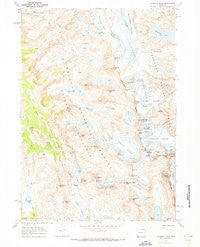
~ Gannett Peak WY topo map, 1:24000 scale, 7.5 X 7.5 Minute, Historical, 1968, updated 1973
Gannett Peak, Wyoming, USGS topographic map dated 1968.
Includes geographic coordinates (latitude and longitude). This topographic map is suitable for hiking, camping, and exploring, or framing it as a wall map.
Printed on-demand using high resolution imagery, on heavy weight and acid free paper, or alternatively on a variety of synthetic materials.
Topos available on paper, Waterproof, Poly, or Tyvek. Usually shipping rolled, unless combined with other folded maps in one order.
- Product Number: USGS-5612088
- Free digital map download (high-resolution, GeoPDF): Gannett Peak, Wyoming (file size: 12 MB)
- Map Size: please refer to the dimensions of the GeoPDF map above
- Weight (paper map): ca. 55 grams
- Map Type: POD USGS Topographic Map
- Map Series: HTMC
- Map Verison: Historical
- Cell ID: 16755
- Scan ID: 339585
- Imprint Year: 1973
- Woodland Tint: Yes
- Aerial Photo Year: 1966
- Field Check Year: 1968
- Datum: NAD27
- Map Projection: Polyconic
- Map published by United States Geological Survey
- Map Language: English
- Scanner Resolution: 600 dpi
- Map Cell Name: Gannett Peak
- Grid size: 7.5 X 7.5 Minute
- Date on map: 1968
- Map Scale: 1:24000
- Geographical region: Wyoming, United States
Neighboring Maps:
All neighboring USGS topo maps are available for sale online at a variety of scales.
Spatial coverage:
Topo map Gannett Peak, Wyoming, covers the geographical area associated the following places:
- Mount Koven - Lost Pipe Lakes - Dinwoody Glaciers - Upper Jean Lake - Bonney Pass - Klondike Peak - Gannett Glacier - Desolation Peak - Tourist Creek - Sulphur Peak - Mount Helen - Desolation Lake - Shannon Pass Trail - Big Tourist Lake - Dinwoody Peak - Glacier Trail - Henderson Peak - Clark Creek - Klondike Lake - Mount Arrowhead - Bobs Towers - Three Forks Park - Baby Glacier - West Sentinel - Wells Creek - Skyline Peak - Pedestal Peak - American Legion Peak - Stroud Peak - Gannett Peak - Knapsack Col - Summit Lake - Pinnacle Ridge - Dale Lake - Mount Oeneis - The Sphinx - Twins Glacier - Mammoth Glacier - Golden Lakes - Philsmith Peak - Winifred Peak - Summer Ice Lake - Scott Lake - Vista Pass - Stroud Glacier - Doublet Peak - Miriam Peak - Stone Pillar Pass - Minor Glacier - Rampart Peak - Mount Woodrow Wilson - Trail Creek - Flagstone Peak - Grasshopper Glacier - Ladd Peak - Mount Whitecap - Sourdough Glacier - Split Mountain - Peak Lake - J Glacier - Brimstone Mountain - Mount Warren - Green River Pass - Dinwoody Glacier - Cube Rock Pass - Bastion Peak - Gooseneck Pinnacle - Twin Peaks - Stonehammer Lake - Gooseneck Glacier - Bow Mountain - Glacier Pass - Flagstone Lake - Mount Solitude - Trail Creek Park - Shannon Pass - Sky Pilot Peak
- Map Area ID: AREA43.2543.125-109.75-109.625
- Northwest corner Lat/Long code: USGSNW43.25-109.75
- Northeast corner Lat/Long code: USGSNE43.25-109.625
- Southwest corner Lat/Long code: USGSSW43.125-109.75
- Southeast corner Lat/Long code: USGSSE43.125-109.625
- Northern map edge Latitude: 43.25
- Southern map edge Latitude: 43.125
- Western map edge Longitude: -109.75
- Eastern map edge Longitude: -109.625


