
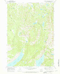
~ Fremont Lake North WY topo map, 1:24000 scale, 7.5 X 7.5 Minute, Historical, 1968, updated 1973
Fremont Lake North, Wyoming, USGS topographic map dated 1968.
Includes geographic coordinates (latitude and longitude). This topographic map is suitable for hiking, camping, and exploring, or framing it as a wall map.
Printed on-demand using high resolution imagery, on heavy weight and acid free paper, or alternatively on a variety of synthetic materials.
Topos available on paper, Waterproof, Poly, or Tyvek. Usually shipping rolled, unless combined with other folded maps in one order.
- Product Number: USGS-5612050
- Free digital map download (high-resolution, GeoPDF): Fremont Lake North, Wyoming (file size: 11 MB)
- Map Size: please refer to the dimensions of the GeoPDF map above
- Weight (paper map): ca. 55 grams
- Map Type: POD USGS Topographic Map
- Map Series: HTMC
- Map Verison: Historical
- Cell ID: 16404
- Scan ID: 339564
- Imprint Year: 1973
- Woodland Tint: Yes
- Visual Version Number: 1
- Aerial Photo Year: 1966
- Field Check Year: 1968
- Datum: NAD27
- Map Projection: Polyconic
- Map published by United States Geological Survey
- Map Language: English
- Scanner Resolution: 600 dpi
- Map Cell Name: Fremont Lake North
- Grid size: 7.5 X 7.5 Minute
- Date on map: 1968
- Map Scale: 1:24000
- Geographical region: Wyoming, United States
Neighboring Maps:
All neighboring USGS topo maps are available for sale online at a variety of scales.
Spatial coverage:
Topo map Fremont Lake North, Wyoming, covers the geographical area associated the following places:
- Gottfried Lake - Crows Nest Lookout - Trapper Lake - Glimpse Lake - Bluff Creek Trail - Heart Lake - Martin Park - Moosehead Bay - Pine Creek Canyon Trail - Pine Mountain - Round Lake - Upper Fremont Lake Campground - Elkhart Park - Faler Creek - Willow Creek Lookout - Snake Lake Trail - Bluff Park Creek - Trapper Lake Stock Trail - Cumberland Creek - Prospector Lake - Indian Park - Rainbow Lake - Section Corner Lake Trail - Bridger Creek - Neil Lake - Bluff Park - Snake Lake - Willow Lake Trail - Fremont Creek - Section Corner Lake - Big Flattop Mountain - Glimpse Lake Trail - Trapper Creek - Willow Lake - Miller Creek - Spring Creek Park - Long Lake Trail - Trail Lake - Crows Nest Lookout - Lily Pond Lake - Cliff Lake - Borum Lake - Big Rock Park - Little Trapper Lake - Lost Camp Lake - Trails End Campground
- Map Area ID: AREA43.12543-109.875-109.75
- Northwest corner Lat/Long code: USGSNW43.125-109.875
- Northeast corner Lat/Long code: USGSNE43.125-109.75
- Southwest corner Lat/Long code: USGSSW43-109.875
- Southeast corner Lat/Long code: USGSSE43-109.75
- Northern map edge Latitude: 43.125
- Southern map edge Latitude: 43
- Western map edge Longitude: -109.875
- Eastern map edge Longitude: -109.75


