
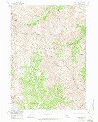
~ Dunrud Peak WY topo map, 1:24000 scale, 7.5 X 7.5 Minute, Historical, 1969, updated 1972
Dunrud Peak, Wyoming, USGS topographic map dated 1969.
Includes geographic coordinates (latitude and longitude). This topographic map is suitable for hiking, camping, and exploring, or framing it as a wall map.
Printed on-demand using high resolution imagery, on heavy weight and acid free paper, or alternatively on a variety of synthetic materials.
Topos available on paper, Waterproof, Poly, or Tyvek. Usually shipping rolled, unless combined with other folded maps in one order.
- Product Number: USGS-5611444
- Free digital map download (high-resolution, GeoPDF): Dunrud Peak, Wyoming (file size: 16 MB)
- Map Size: please refer to the dimensions of the GeoPDF map above
- Weight (paper map): ca. 55 grams
- Map Type: POD USGS Topographic Map
- Map Series: HTMC
- Map Verison: Historical
- Cell ID: 69935
- Scan ID: 339267
- Imprint Year: 1972
- Woodland Tint: Yes
- Aerial Photo Year: 1955
- Field Check Year: 1969
- Datum: NAD27
- Map Projection: Polyconic
- Map published by United States Geological Survey
- Map published by United States Forest Service
- Map Language: English
- Scanner Resolution: 600 dpi
- Map Cell Name: Dunrud Peak
- Grid size: 7.5 X 7.5 Minute
- Date on map: 1969
- Map Scale: 1:24000
- Geographical region: Wyoming, United States
Neighboring Maps:
All neighboring USGS topo maps are available for sale online at a variety of scales.
Spatial coverage:
Topo map Dunrud Peak, Wyoming, covers the geographical area associated the following places:
- Bryan Mine - Smuggler Gulch Trail - Pickwick Mine - Steamboat Rock - Ninemile Trail - Dunrud Peak - Bear Creek Pass - Horse Creek - County Peak - Absaroka Trail - Cascade Creek - Dollar Mountain - East Fork Pass - Mineral Mountain - Bald Mountain - East Fork East Fork Wind River - Coal Chute Pass - Kirwin Mine - Mount Sniffel - Cascade Creek Trail - East Fork Trail - Spar Mountain - Name Creek - Kirwin District Mine - Tumlum Mine - Wolf Shaft - Smuggler Mine
- Map Area ID: AREA43.87543.75-109.375-109.25
- Northwest corner Lat/Long code: USGSNW43.875-109.375
- Northeast corner Lat/Long code: USGSNE43.875-109.25
- Southwest corner Lat/Long code: USGSSW43.75-109.375
- Southeast corner Lat/Long code: USGSSE43.75-109.25
- Northern map edge Latitude: 43.875
- Southern map edge Latitude: 43.75
- Western map edge Longitude: -109.375
- Eastern map edge Longitude: -109.25


