
~ Dome Lake WY topo map, 1:24000 scale, 7.5 X 7.5 Minute, Historical, 1993, updated 1997
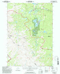
Dome Lake, Wyoming, USGS topographic map dated 1993.
Includes geographic coordinates (latitude and longitude). This topographic map is suitable for hiking, camping, and exploring, or framing it as a wall map.
Printed on-demand using high resolution imagery, on heavy weight and acid free paper, or alternatively on a variety of synthetic materials.
Topos available on paper, Waterproof, Poly, or Tyvek. Usually shipping rolled, unless combined with other folded maps in one order.
- Product Number: USGS-5611330
- Free digital map download (high-resolution, GeoPDF): Dome Lake, Wyoming (file size: 12 MB)
- Map Size: please refer to the dimensions of the GeoPDF map above
- Weight (paper map): ca. 55 grams
- Map Type: POD USGS Topographic Map
- Map Series: HTMC
- Map Verison: Historical
- Cell ID: 12502
- Scan ID: 339212
- Imprint Year: 1997
- Woodland Tint: Yes
- Aerial Photo Year: 1963
- Field Check Year: 1992
- Datum: NAD27
- Map Projection: Polyconic
- Map published by United States Geological Survey
- Map published by United States Forest Service
- Map Language: English
- Scanner Resolution: 600 dpi
- Map Cell Name: Dome Lake
- Grid size: 7.5 X 7.5 Minute
- Date on map: 1993
- Map Scale: 1:24000
- Geographical region: Wyoming, United States
Neighboring Maps:
All neighboring USGS topo maps are available for sale online at a variety of scales.
Spatial coverage:
Topo map Dome Lake, Wyoming, covers the geographical area associated the following places:
- Black Rib - Twin Lakes Campground - Coney Lake - Rock Chuck Pass - Rinehart Lakes - Twin Lakes Number 2 - Stull Lakes - Geddes Lake - Porcupine Creek - Lake Fontanalis - Heart Lake - Sawmill Lakes - Twin Lakes Number 1 Dam - Twin Lakes Number 2 Dam - Snail Creek - Dome Lake - Twin Lakes Picnic Area - Dome Lake Number 1 - Duck Pond - Lake Shamrock - Preacher Rock - Bighorn Mountains - Grubstake Syndicate Mine - Twin Lakes - Lake Buffalo - Lake Alibi - Coney Creek - Elk Pass - Lake Dunchi - Dome Lake Number 1 Dam - Dome Lake Reservoir - Weston Point - Weston Reservoir - Wilderness Creek - Crescent Lake - Hope Lake - Lost Lake - Dome Rock - Edelman Creek - Weston Reservoir - Saddle Mountain - Weston Dam - Lake Mirage - Elk Peak - Bighorn National Forest - Sawmill Dam
- Map Area ID: AREA44.62544.5-107.375-107.25
- Northwest corner Lat/Long code: USGSNW44.625-107.375
- Northeast corner Lat/Long code: USGSNE44.625-107.25
- Southwest corner Lat/Long code: USGSSW44.5-107.375
- Southeast corner Lat/Long code: USGSSE44.5-107.25
- Northern map edge Latitude: 44.625
- Southern map edge Latitude: 44.5
- Western map edge Longitude: -107.375
- Eastern map edge Longitude: -107.25


