
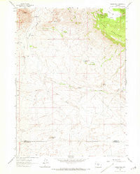
~ Crooks Peak WY topo map, 1:24000 scale, 7.5 X 7.5 Minute, Historical, 1961, updated 1973
Crooks Peak, Wyoming, USGS topographic map dated 1961.
Includes geographic coordinates (latitude and longitude). This topographic map is suitable for hiking, camping, and exploring, or framing it as a wall map.
Printed on-demand using high resolution imagery, on heavy weight and acid free paper, or alternatively on a variety of synthetic materials.
Topos available on paper, Waterproof, Poly, or Tyvek. Usually shipping rolled, unless combined with other folded maps in one order.
- Product Number: USGS-5611054
- Free digital map download (high-resolution, GeoPDF): Crooks Peak, Wyoming (file size: 10 MB)
- Map Size: please refer to the dimensions of the GeoPDF map above
- Weight (paper map): ca. 55 grams
- Map Type: POD USGS Topographic Map
- Map Series: HTMC
- Map Verison: Historical
- Cell ID: 10790
- Scan ID: 339072
- Imprint Year: 1973
- Woodland Tint: Yes
- Aerial Photo Year: 1960
- Field Check Year: 1961
- Datum: NAD27
- Map Projection: Polyconic
- Map published by United States Geological Survey
- Map Language: English
- Scanner Resolution: 600 dpi
- Map Cell Name: Crooks Peak
- Grid size: 7.5 X 7.5 Minute
- Date on map: 1961
- Map Scale: 1:24000
- Geographical region: Wyoming, United States
Neighboring Maps:
All neighboring USGS topo maps are available for sale online at a variety of scales.
Spatial coverage:
Topo map Crooks Peak, Wyoming, covers the geographical area associated the following places:
- Bare Ring Slough - J.J Claims Number Four Mine - Waverly Claims - Rock Reservoir - Snoball Mine - Sun Number Three P Sundog Number Two Mine - McThomas Number Two Mine - Jenson Ranch - Crooks Gap - Bare Ring Butte - Utah Mine - Taggart Meadows - Troy Number Thirteen Mine - Sheep Mountain - Lost Creek Claims - Snoball Number Three Mine - Crooks Peak - Rock Dam - Fourth Creek - Big Bertha Mine - West Fork Crooks Creek - Crooks Creek Reservoir - Sun Number Four Mine - Sun and Sunday Claims - Big Eagle Mine - McIntosh Pit - Spring Creek - Jost Creek - B Seventeen-Eighteen Mine - Butte Mine - Sheep Creek Park - Sand Spring - Sheep Mountain Number One Mine
- Map Area ID: AREA42.37542.25-107.875-107.75
- Northwest corner Lat/Long code: USGSNW42.375-107.875
- Northeast corner Lat/Long code: USGSNE42.375-107.75
- Southwest corner Lat/Long code: USGSSW42.25-107.875
- Southeast corner Lat/Long code: USGSSE42.25-107.75
- Northern map edge Latitude: 42.375
- Southern map edge Latitude: 42.25
- Western map edge Longitude: -107.875
- Eastern map edge Longitude: -107.75


