
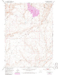
~ Coyote Springs WY topo map, 1:24000 scale, 7.5 X 7.5 Minute, Historical, 1952, updated 1985
Coyote Springs, Wyoming, USGS topographic map dated 1952.
Includes geographic coordinates (latitude and longitude). This topographic map is suitable for hiking, camping, and exploring, or framing it as a wall map.
Printed on-demand using high resolution imagery, on heavy weight and acid free paper, or alternatively on a variety of synthetic materials.
Topos available on paper, Waterproof, Poly, or Tyvek. Usually shipping rolled, unless combined with other folded maps in one order.
- Product Number: USGS-5611002
- Free digital map download (high-resolution, GeoPDF): Coyote Springs, Wyoming (file size: 10 MB)
- Map Size: please refer to the dimensions of the GeoPDF map above
- Weight (paper map): ca. 55 grams
- Map Type: POD USGS Topographic Map
- Map Series: HTMC
- Map Verison: Historical
- Cell ID: 10524
- Scan ID: 339043
- Imprint Year: 1985
- Photo Revision Year: 1984
- Aerial Photo Year: 1980
- Edit Year: 1984
- Field Check Year: 1952
- Datum: NAD27
- Map Projection: Polyconic
- Map published by United States Geological Survey
- Map Language: English
- Scanner Resolution: 600 dpi
- Map Cell Name: Coyote Springs
- Grid size: 7.5 X 7.5 Minute
- Date on map: 1952
- Map Scale: 1:24000
- Geographical region: Wyoming, United States
Neighboring Maps:
All neighboring USGS topo maps are available for sale online at a variety of scales.
Spatial coverage:
Topo map Coyote Springs, Wyoming, covers the geographical area associated the following places:
- Loco N-1, N-2 Mine - Mud Springs - Loma Mine Group - Spring Creek - East Dam - Keeno Number One Mine - Reno Number One Mine - Clyde Number Three Mine - Clyde Number Five Mine - Loco Bret A2C, C-2 Number One Mine - Loco M, L, K Mine - Loma-Day Claims - Loco D Mine - Day South Reservoir - Loco C Mine - The Dry Lakes - Coyote Springs - Clyde Mines - East Reservoir - Wild Horse Springs - Clyde Bret Mine - Coco Underground Number One Mine - Clyde, A, B, A-1, A2C Mine - Clyde Mine - Day South Dam - Diamond Springs Well - Day Ore Pad Dam - Nels Number Twenty Mine - Day Number Twenty-six Mine - Nels Number Eight Mine - B. T. W. Number Eighteen Mine - Day Mine - Federal American Open Pit - RMCC Number Eight Mine - Bum Steer Number One Mine - Day Ore Pad Reservoir - West Diamond Springs Draw
- Map Area ID: AREA42.7542.625-107.75-107.625
- Northwest corner Lat/Long code: USGSNW42.75-107.75
- Northeast corner Lat/Long code: USGSNE42.75-107.625
- Southwest corner Lat/Long code: USGSSW42.625-107.75
- Southeast corner Lat/Long code: USGSSE42.625-107.625
- Northern map edge Latitude: 42.75
- Southern map edge Latitude: 42.625
- Western map edge Longitude: -107.75
- Eastern map edge Longitude: -107.625


