
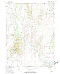
~ Cow Creek WY topo map, 1:24000 scale, 7.5 X 7.5 Minute, Historical, 1961, updated 1985
Cow Creek, Wyoming, USGS topographic map dated 1961.
Includes geographic coordinates (latitude and longitude). This topographic map is suitable for hiking, camping, and exploring, or framing it as a wall map.
Printed on-demand using high resolution imagery, on heavy weight and acid free paper, or alternatively on a variety of synthetic materials.
Topos available on paper, Waterproof, Poly, or Tyvek. Usually shipping rolled, unless combined with other folded maps in one order.
- Product Number: USGS-5610982
- Free digital map download (high-resolution, GeoPDF): Cow Creek, Wyoming (file size: 11 MB)
- Map Size: please refer to the dimensions of the GeoPDF map above
- Weight (paper map): ca. 55 grams
- Map Type: POD USGS Topographic Map
- Map Series: HTMC
- Map Verison: Historical
- Cell ID: 10420
- Scan ID: 339029
- Imprint Year: 1985
- Woodland Tint: Yes
- Aerial Photo Year: 1958
- Field Check Year: 1961
- Datum: NAD27
- Map Projection: Polyconic
- Map published by United States Geological Survey
- Map Language: English
- Scanner Resolution: 600 dpi
- Map Cell Name: Cow Creek
- Grid size: 7.5 X 7.5 Minute
- Date on map: 1961
- Map Scale: 1:24000
- Geographical region: Wyoming, United States
Neighboring Maps:
All neighboring USGS topo maps are available for sale online at a variety of scales.
Spatial coverage:
Topo map Cow Creek, Wyoming, covers the geographical area associated the following places:
- Hopkins Number 1 Ditch - Wood Draw - Wyco Club - Elk Hollow Ranch - Baggot Rocks - Antelope Draw - Cornerstone Draw - Rainbow Ranch - McCold Draw - Reynolds Run - Ryan Ranch - Elk Hollow Ditch - Rainbow Canyon - Canyon - Cherokee Creek - North Draw - Sixteen Gulch - Pearce Draw - Loski Ditch - Brush Creek Supply Ditch - Beaver Creek - Flying Diamond Ranch - Paine Deposit - Needle Peak - Days - Cyclops Ditch - Windall Ditch - Encampment Platte Valley Ditch - Big Springs Draw - Harrison Creek - Elk Hollow Creek - Donzelman and Tilton Ditch - Ridding Number 1 Ditch - Cow Creek - Encampment River
- Map Area ID: AREA41.37541.25-106.75-106.625
- Northwest corner Lat/Long code: USGSNW41.375-106.75
- Northeast corner Lat/Long code: USGSNE41.375-106.625
- Southwest corner Lat/Long code: USGSSW41.25-106.75
- Southeast corner Lat/Long code: USGSSE41.25-106.625
- Northern map edge Latitude: 41.375
- Southern map edge Latitude: 41.25
- Western map edge Longitude: -106.75
- Eastern map edge Longitude: -106.625


