
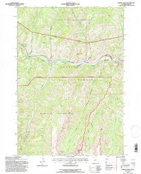
~ Chimney Rock WY topo map, 1:24000 scale, 7.5 X 7.5 Minute, Historical, 1991, updated 1997
Chimney Rock, Wyoming, USGS topographic map dated 1991.
Includes geographic coordinates (latitude and longitude). This topographic map is suitable for hiking, camping, and exploring, or framing it as a wall map.
Printed on-demand using high resolution imagery, on heavy weight and acid free paper, or alternatively on a variety of synthetic materials.
Topos available on paper, Waterproof, Poly, or Tyvek. Usually shipping rolled, unless combined with other folded maps in one order.
- Product Number: USGS-5610712
- Free digital map download (high-resolution, GeoPDF): Chimney Rock, Wyoming (file size: 17 MB)
- Map Size: please refer to the dimensions of the GeoPDF map above
- Weight (paper map): ca. 55 grams
- Map Type: POD USGS Topographic Map
- Map Series: HTMC
- Map Verison: Historical
- Cell ID: 8560
- Scan ID: 338905
- Imprint Year: 1997
- Woodland Tint: Yes
- Aerial Photo Year: 1989
- Field Check Year: 1991
- Datum: NAD27
- Map Projection: Transverse Mercator
- Map published by United States Geological Survey
- Map published by United States Forest Service
- Map Language: English
- Scanner Resolution: 600 dpi
- Map Cell Name: Chimney Rock
- Grid size: 7.5 X 7.5 Minute
- Date on map: 1991
- Map Scale: 1:24000
- Geographical region: Wyoming, United States
Neighboring Maps:
All neighboring USGS topo maps are available for sale online at a variety of scales.
Spatial coverage:
Topo map Chimney Rock, Wyoming, covers the geographical area associated the following places:
- Fire Memorial Trail - Newton Creek - Newton Creek Campground - The Palisades - Fishhawk Creek - Goff Creek - Norris Creek - Wayfares Chapel - Sheep Creek - Libby Creek - Henry Ford Rock - Newton Spring - Gunbarrel Creek - Mesa Creek - Window Rock - Blackwater Trail - West Fork Blackwater Creek - Chimney Creek - Natural Bridge Trail - Newton Spring Picnic Ground - Elephant Head Rock - Kitty Creek Summer Homes - Chimney Rock
- Map Area ID: AREA44.544.375-109.875-109.75
- Northwest corner Lat/Long code: USGSNW44.5-109.875
- Northeast corner Lat/Long code: USGSNE44.5-109.75
- Southwest corner Lat/Long code: USGSSW44.375-109.875
- Southeast corner Lat/Long code: USGSSE44.375-109.75
- Northern map edge Latitude: 44.5
- Southern map edge Latitude: 44.375
- Western map edge Longitude: -109.875
- Eastern map edge Longitude: -109.75


