
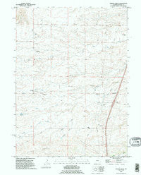
~ Bristol Ridge WY topo map, 1:24000 scale, 7.5 X 7.5 Minute, Historical, 1990, updated 1995
Bristol Ridge, Wyoming, USGS topographic map dated 1990.
Includes geographic coordinates (latitude and longitude). This topographic map is suitable for hiking, camping, and exploring, or framing it as a wall map.
Printed on-demand using high resolution imagery, on heavy weight and acid free paper, or alternatively on a variety of synthetic materials.
Topos available on paper, Waterproof, Poly, or Tyvek. Usually shipping rolled, unless combined with other folded maps in one order.
- Product Number: USGS-5610240
- Free digital map download (high-resolution, GeoPDF): Bristol Ridge, Wyoming (file size: 10 MB)
- Map Size: please refer to the dimensions of the GeoPDF map above
- Weight (paper map): ca. 55 grams
- Map Type: POD USGS Topographic Map
- Map Series: HTMC
- Map Verison: Historical
- Cell ID: 5516
- Scan ID: 338668
- Imprint Year: 1995
- Woodland Tint: Yes
- Aerial Photo Year: 1990
- Edit Year: 1995
- Datum: NAD27
- Map Projection: Universal Transverse Mercator
- Map published by United States Geological Survey
- Map Language: English
- Scanner Resolution: 600 dpi
- Map Cell Name: Bristol Ridge
- Grid size: 7.5 X 7.5 Minute
- Date on map: 1990
- Map Scale: 1:24000
- Geographical region: Wyoming, United States
Neighboring Maps:
All neighboring USGS topo maps are available for sale online at a variety of scales.
Spatial coverage:
Topo map Bristol Ridge, Wyoming, covers the geographical area associated the following places:
- Collins Ranch - Russell Dayton Ranch - Richards Hall - Sweet Draw - Caster Ranch - Mable Ranch - McCann Draw - Bliss Pumping Station - Hoyt Duvall Ranch - Harry Dayton Ranch - Bristol Ridge - Bert Gillaspie Ranch - Nimmo Reservoir Number 9 - North Fork South Fork Bear Creek - Chalk Hill - Elvy Gillaspie Ranch - Little Bear Cemetery - F L Duvall Ranch - Dick Duvall Ranch
- Map Area ID: AREA41.62541.5-105-104.875
- Northwest corner Lat/Long code: USGSNW41.625-105
- Northeast corner Lat/Long code: USGSNE41.625-104.875
- Southwest corner Lat/Long code: USGSSW41.5-105
- Southeast corner Lat/Long code: USGSSE41.5-104.875
- Northern map edge Latitude: 41.625
- Southern map edge Latitude: 41.5
- Western map edge Longitude: -105
- Eastern map edge Longitude: -104.875


