
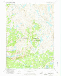
~ Bridger Lakes WY topo map, 1:24000 scale, 7.5 X 7.5 Minute, Historical, 1968, updated 1974
Bridger Lakes, Wyoming, USGS topographic map dated 1968.
Includes geographic coordinates (latitude and longitude). This topographic map is suitable for hiking, camping, and exploring, or framing it as a wall map.
Printed on-demand using high resolution imagery, on heavy weight and acid free paper, or alternatively on a variety of synthetic materials.
Topos available on paper, Waterproof, Poly, or Tyvek. Usually shipping rolled, unless combined with other folded maps in one order.
- Product Number: USGS-5610196
- Free digital map download (high-resolution, GeoPDF): Bridger Lakes, Wyoming (file size: 12 MB)
- Map Size: please refer to the dimensions of the GeoPDF map above
- Weight (paper map): ca. 55 grams
- Map Type: POD USGS Topographic Map
- Map Series: HTMC
- Map Verison: Historical
- Cell ID: 5425
- Scan ID: 338651
- Imprint Year: 1974
- Woodland Tint: Yes
- Aerial Photo Year: 1966
- Field Check Year: 1968
- Datum: NAD27
- Map Projection: Polyconic
- Map published by United States Geological Survey
- Map Language: English
- Scanner Resolution: 600 dpi
- Map Cell Name: Bridger Lakes
- Grid size: 7.5 X 7.5 Minute
- Date on map: 1968
- Map Scale: 1:24000
- Geographical region: Wyoming, United States
Neighboring Maps:
All neighboring USGS topo maps are available for sale online at a variety of scales.
Spatial coverage:
Topo map Bridger Lakes, Wyoming, covers the geographical area associated the following places:
- Hobbs Lake - Pole Creek Trail - Fremont Crossing - Little Seneca Lake - Seneca Lake Trail - Sweeney Lakes - Duran Peak - Gunsight Pass - Lake Nelson - Lester Pass - Sapphire Lake - Elbow Peak - Threlkeld Pass - Indian Pass Trail - Big Water Slide - Elbow Lake - Long Lake - Lower Jean Lake - Titcomb Lakes - Upper Long Lake - Mistake Lake - Upper Sweeney Lake - Gorge Lake - Barbara Lake - Titcomb Basin Trail - Photographers Point - Guiterrez Peak - Miner Lake - Suicide Lake - Eklund Lake - Twin Lakes - Triangle Lake - Moya Canyon - Middle Sweeney Lake - Monument Creek - Seneca Lake - Elbow Creek - Marys Lake - Pass Lake - Two Top Lakes - Mistake Lake - 1000 Island Lake - Island Lake - Miller Park - Lost Lake - Pole Creek Lakes - Miller Lake - Bridger Lakes - Sauerkraut Lakes
- Map Area ID: AREA43.12543-109.75-109.625
- Northwest corner Lat/Long code: USGSNW43.125-109.75
- Northeast corner Lat/Long code: USGSNE43.125-109.625
- Southwest corner Lat/Long code: USGSSW43-109.75
- Southeast corner Lat/Long code: USGSSE43-109.625
- Northern map edge Latitude: 43.125
- Southern map edge Latitude: 43
- Western map edge Longitude: -109.75
- Eastern map edge Longitude: -109.625


