
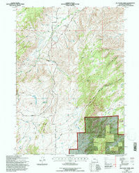
~ Blue Nose Creek WY topo map, 1:24000 scale, 7.5 X 7.5 Minute, Historical, 1992, updated 1996
Blue Nose Creek, Wyoming, USGS topographic map dated 1992.
Includes geographic coordinates (latitude and longitude). This topographic map is suitable for hiking, camping, and exploring, or framing it as a wall map.
Printed on-demand using high resolution imagery, on heavy weight and acid free paper, or alternatively on a variety of synthetic materials.
Topos available on paper, Waterproof, Poly, or Tyvek. Usually shipping rolled, unless combined with other folded maps in one order.
- Product Number: USGS-5610040
- Free digital map download (high-resolution, GeoPDF): Blue Nose Creek, Wyoming (file size: 17 MB)
- Map Size: please refer to the dimensions of the GeoPDF map above
- Weight (paper map): ca. 55 grams
- Map Type: POD USGS Topographic Map
- Map Series: HTMC
- Map Verison: Historical
- Cell ID: 4541
- Scan ID: 338571
- Imprint Year: 1996
- Woodland Tint: Yes
- Aerial Photo Year: 1963
- Field Check Year: 1992
- Datum: NAD27
- Map Projection: Transverse Mercator
- Map published by United States Geological Survey
- Map published by United States Forest Service
- Map Language: English
- Scanner Resolution: 600 dpi
- Map Cell Name: Blue Nose Creek
- Grid size: 7.5 X 7.5 Minute
- Date on map: 1992
- Map Scale: 1:24000
- Geographical region: Wyoming, United States
Neighboring Maps:
All neighboring USGS topo maps are available for sale online at a variety of scales.
Spatial coverage:
Topo map Blue Nose Creek, Wyoming, covers the geographical area associated the following places:
- Baldy Point - Wagon Hound Falls - Perry Creek - Red Fern Creek - Point of Rocks Creek - Badger Creek - Dry Fork La Prele Creek - Cache Creek - Redenbaugh Pass - Moss Agate School - Jackson Creek - Gata Number 2 Reservoir - North Curtis Creek - Chamberlain Place - Orville Draw - Wolf Creek - Moses Park - Cow Creek - Beaulieu Lakes - Caffee Point - Little La Prele Creek - Curtis Creek - Spracklin Branch - Lambe Ditch Number 1 - Buckhorn Creek - Carbo Draw - Blue Nose Creek - Spring Creek - Meadow Creek - Point of Rocks - Virden Pass - Hay Press Meadows - Long Reservoir
- Map Area ID: AREA42.62542.5-105.75-105.625
- Northwest corner Lat/Long code: USGSNW42.625-105.75
- Northeast corner Lat/Long code: USGSNE42.625-105.625
- Southwest corner Lat/Long code: USGSSW42.5-105.75
- Southeast corner Lat/Long code: USGSSE42.5-105.625
- Northern map edge Latitude: 42.625
- Southern map edge Latitude: 42.5
- Western map edge Longitude: -105.75
- Eastern map edge Longitude: -105.625


