
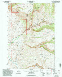
~ Black Mountain WY topo map, 1:24000 scale, 7.5 X 7.5 Minute, Historical, 1993, updated 1997
Black Mountain, Wyoming, USGS topographic map dated 1993.
Includes geographic coordinates (latitude and longitude). This topographic map is suitable for hiking, camping, and exploring, or framing it as a wall map.
Printed on-demand using high resolution imagery, on heavy weight and acid free paper, or alternatively on a variety of synthetic materials.
Topos available on paper, Waterproof, Poly, or Tyvek. Usually shipping rolled, unless combined with other folded maps in one order.
- Product Number: USGS-5609958
- Free digital map download (high-resolution, GeoPDF): Black Mountain, Wyoming (file size: 15 MB)
- Map Size: please refer to the dimensions of the GeoPDF map above
- Weight (paper map): ca. 55 grams
- Map Type: POD USGS Topographic Map
- Map Series: HTMC
- Map Verison: Historical
- Cell ID: 4158
- Scan ID: 338530
- Imprint Year: 1997
- Woodland Tint: Yes
- Aerial Photo Year: 1989
- Field Check Year: 1993
- Datum: NAD27
- Map Projection: Lambert Conformal Conic
- Map published by United States Geological Survey
- Map published by United States Forest Service
- Map Language: English
- Scanner Resolution: 600 dpi
- Map Cell Name: Black Mountain
- Grid size: 7.5 X 7.5 Minute
- Date on map: 1993
- Map Scale: 1:24000
- Geographical region: Wyoming, United States
Neighboring Maps:
All neighboring USGS topo maps are available for sale online at a variety of scales.
Spatial coverage:
Topo map Black Mountain, Wyoming, covers the geographical area associated the following places:
- Spring Creek - Shelly Gulch - Fender Creek - Elephant Head Rock - Dry Fork White Creek - Hatten Ditch - Shell Creek Canyon Mine - Iowa State University Geology Camp - Table Mountain - Cedar Creek - Post Creek - Horse Mountain Gulch - Sunlight Canyon - Red Butte - Trapper Lodge Ranch - Trone Gulch - McNay Creek - Horse Mountain - Barrel Spring - White Creek - Corral Gulch - Lake Ridge - Chimney Rock - Trapper Canyon - Shell Canyon - Black Mountain - Sunlight Gulch - Bush Creek - Kershner Ditch - Post Creek Picnic Area - Chimney Rock - Bear Gulch - Survey Creek - Sunlight Mesa - Amber Gulch - Cottonwood Creek
- Map Area ID: AREA44.62544.5-107.75-107.625
- Northwest corner Lat/Long code: USGSNW44.625-107.75
- Northeast corner Lat/Long code: USGSNE44.625-107.625
- Southwest corner Lat/Long code: USGSSW44.5-107.75
- Southeast corner Lat/Long code: USGSSE44.5-107.625
- Northern map edge Latitude: 44.625
- Southern map edge Latitude: 44.5
- Western map edge Longitude: -107.75
- Eastern map edge Longitude: -107.625


