
~ Big Piney West WY topo map, 1:24000 scale, 7.5 X 7.5 Minute, Historical, 1970, updated 1973
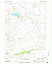
Big Piney West, Wyoming, USGS topographic map dated 1970.
Includes geographic coordinates (latitude and longitude). This topographic map is suitable for hiking, camping, and exploring, or framing it as a wall map.
Printed on-demand using high resolution imagery, on heavy weight and acid free paper, or alternatively on a variety of synthetic materials.
Topos available on paper, Waterproof, Poly, or Tyvek. Usually shipping rolled, unless combined with other folded maps in one order.
- Product Number: USGS-5609866
- Free digital map download (high-resolution, GeoPDF): Big Piney West, Wyoming (file size: 8 MB)
- Map Size: please refer to the dimensions of the GeoPDF map above
- Weight (paper map): ca. 55 grams
- Map Type: POD USGS Topographic Map
- Map Series: HTMC
- Map Verison: Historical
- Cell ID: 3797
- Scan ID: 338483
- Imprint Year: 1973
- Woodland Tint: Yes
- Aerial Photo Year: 1969
- Field Check Year: 1970
- Datum: NAD27
- Map Projection: Polyconic
- Map published by United States Geological Survey
- Map Language: English
- Scanner Resolution: 600 dpi
- Map Cell Name: Big Piney West
- Grid size: 7.5 X 7.5 Minute
- Date on map: 1970
- Map Scale: 1:24000
- Geographical region: Wyoming, United States
Neighboring Maps:
All neighboring USGS topo maps are available for sale online at a variety of scales.
Spatial coverage:
Topo map Big Piney West, Wyoming, covers the geographical area associated the following places:
- Plainview Cemetery - Spring Creek - West Channel - Wilson Ditch - McNinch Ditch - Osterhout Edwards Ditch - Homestake Ditch - Deer Hill Draw - East Channel - Abo Ditch - Sixty-Seven Reservoir - Holden Ditch - Yankee Ditch - South McKay Ditch Number 2 - East Star Corral Oil Field - Tarter Ditch - D B Budd Butte - Homer Ditch Number 1 - Reardon Ditch - H McKay Ditch - Sixty-Seven Reservoir Dam - Sixty-Seven Draw - Summit Ditch - Sixty-Seven Reservoir Distribution - Sixty-Seven Butte - South Piney Ditch - McNinch Wash - Lehmer Ditch - Meadow Canyon Swale
- Map Area ID: AREA42.62542.5-110.25-110.125
- Northwest corner Lat/Long code: USGSNW42.625-110.25
- Northeast corner Lat/Long code: USGSNE42.625-110.125
- Southwest corner Lat/Long code: USGSSW42.5-110.25
- Southeast corner Lat/Long code: USGSSE42.5-110.125
- Northern map edge Latitude: 42.625
- Southern map edge Latitude: 42.5
- Western map edge Longitude: -110.25
- Eastern map edge Longitude: -110.125


