
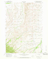
~ Beaver Creek Hills WY topo map, 1:24000 scale, 7.5 X 7.5 Minute, Historical, 1964, updated 1968
Beaver Creek Hills, Wyoming, USGS topographic map dated 1964.
Includes geographic coordinates (latitude and longitude). This topographic map is suitable for hiking, camping, and exploring, or framing it as a wall map.
Printed on-demand using high resolution imagery, on heavy weight and acid free paper, or alternatively on a variety of synthetic materials.
Topos available on paper, Waterproof, Poly, or Tyvek. Usually shipping rolled, unless combined with other folded maps in one order.
- Product Number: USGS-5609754
- Free digital map download (high-resolution, GeoPDF): Beaver Creek Hills, Wyoming (file size: 11 MB)
- Map Size: please refer to the dimensions of the GeoPDF map above
- Weight (paper map): ca. 55 grams
- Map Type: POD USGS Topographic Map
- Map Series: HTMC
- Map Verison: Historical
- Cell ID: 2933
- Scan ID: 338430
- Imprint Year: 1968
- Woodland Tint: Yes
- Aerial Photo Year: 1963
- Field Check Year: 1964
- Datum: NAD27
- Map Projection: Polyconic
- Map published by United States Geological Survey
- Map Language: English
- Scanner Resolution: 600 dpi
- Map Cell Name: Beaver Creek Hills
- Grid size: 7.5 X 7.5 Minute
- Date on map: 1964
- Map Scale: 1:24000
- Geographical region: Wyoming, United States
Neighboring Maps:
All neighboring USGS topo maps are available for sale online at a variety of scales.
Spatial coverage:
Topo map Beaver Creek Hills, Wyoming, covers the geographical area associated the following places:
- North Coyote Draw - Jerry Johns Reservoir Number 1 - Trabing Creek - Lone Star Creek - West Fork Davis Creek - Baker Draw - Government Gap - Big Goose and Beaver Ditch - Bear Gulch - Bracket Number 3 Reservoir - Barr Draw - Hurlburt Creek - Beaver Creek Hills - Apple Run - White Creek - Ditch Number 9 - Jerry Johns Reservoir Number 1 Dam - Sheridan South Division - East Fork Davis Creek - Garber Draw - W S Draw - Darlington Draw - Gallatin Draw - Alder Gulch - Bracket Number 3 Dam - Davis Creek - Red Grade Spring Draw - South Coyote Draw - Curlew Hill - Colorado Colony Ditch - Peralta Ditch - Hill Creek
- Map Area ID: AREA44.7544.625-107.125-107
- Northwest corner Lat/Long code: USGSNW44.75-107.125
- Northeast corner Lat/Long code: USGSNE44.75-107
- Southwest corner Lat/Long code: USGSSW44.625-107.125
- Southeast corner Lat/Long code: USGSSE44.625-107
- Northern map edge Latitude: 44.75
- Southern map edge Latitude: 44.625
- Western map edge Longitude: -107.125
- Eastern map edge Longitude: -107


