
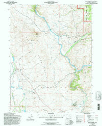
~ Barcus Peak WY topo map, 1:24000 scale, 7.5 X 7.5 Minute, Historical, 1992, updated 1996
Barcus Peak, Wyoming, USGS topographic map dated 1992.
Includes geographic coordinates (latitude and longitude). This topographic map is suitable for hiking, camping, and exploring, or framing it as a wall map.
Printed on-demand using high resolution imagery, on heavy weight and acid free paper, or alternatively on a variety of synthetic materials.
Topos available on paper, Waterproof, Poly, or Tyvek. Usually shipping rolled, unless combined with other folded maps in one order.
- Product Number: USGS-5609666
- Free digital map download (high-resolution, GeoPDF): Barcus Peak, Wyoming (file size: 12 MB)
- Map Size: please refer to the dimensions of the GeoPDF map above
- Weight (paper map): ca. 55 grams
- Map Type: POD USGS Topographic Map
- Map Series: HTMC
- Map Verison: Historical
- Cell ID: 2388
- Scan ID: 338383
- Imprint Year: 1996
- Woodland Tint: Yes
- Aerial Photo Year: 1989
- Field Check Year: 1992
- Datum: NAD27
- Map Projection: Transverse Mercator
- Map published by United States Geological Survey
- Map published by United States Forest Service
- Map Language: English
- Scanner Resolution: 600 dpi
- Map Cell Name: Barcus Peak
- Grid size: 7.5 X 7.5 Minute
- Date on map: 1992
- Map Scale: 1:24000
- Geographical region: Wyoming, United States
Neighboring Maps:
All neighboring USGS topo maps are available for sale online at a variety of scales.
Spatial coverage:
Topo map Barcus Peak, Wyoming, covers the geographical area associated the following places:
- Addison Gulch - Fingerle Hollow - Coyote Hill - Little Creek - Summit Reservoir - Barcus Peak - Golden Clover Reservoir Number 2 - Bacus Ditch - Platt Ranch - Golden Clover Number 1 Dam - Reservoir Creek - Barcus Creek - Toothaker Dam - Rocky Point Ditch - Beaver Creek Hills - Sanger Draw - Golden Clover Reservoir Number 1 - Rollman Reservoir - Platt Ranch Airport (historical) - Toothaker Reservoir - Big Spring - Homestead Draw - Jenkins Ranch - Summit Dam - Beaver Creek School - Jenkins Peak - Bear Creek - Big Hollow - Bull Canyon - Big Hollow Gulch - Platt Cemetery - French Creek Ranch - Slims Draw - Golden Clover Mine - Bull Creek - School Creek - Sanger Ranch - Bear Gulch - Rocky Point Ditch - A Bar A Ranch Airport - Big Creek - Little Beaver Creek - French Creek
- Map Area ID: AREA41.2541.125-106.625-106.5
- Northwest corner Lat/Long code: USGSNW41.25-106.625
- Northeast corner Lat/Long code: USGSNE41.25-106.5
- Southwest corner Lat/Long code: USGSSW41.125-106.625
- Southeast corner Lat/Long code: USGSSE41.125-106.5
- Northern map edge Latitude: 41.25
- Southern map edge Latitude: 41.125
- Western map edge Longitude: -106.625
- Eastern map edge Longitude: -106.5


