
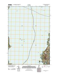
~ Juniper Island VT topo map, 1:24000 scale, 7.5 X 7.5 Minute, Historical, 2012
Juniper Island, Vermont, USGS topographic map dated 2012.
Includes geographic coordinates (latitude and longitude). This topographic map is suitable for hiking, camping, and exploring, or framing it as a wall map.
Printed on-demand using high resolution imagery, on heavy weight and acid free paper, or alternatively on a variety of synthetic materials.
Topos available on paper, Waterproof, Poly, or Tyvek. Usually shipping rolled, unless combined with other folded maps in one order.
- Product Number: USGS-5601490
- Free digital map download (high-resolution, GeoPDF): Juniper Island, Vermont (file size: 22 MB)
- Map Size: please refer to the dimensions of the GeoPDF map above
- Weight (paper map): ca. 55 grams
- Map Type: POD USGS Topographic Map
- Map Series: US Topo
- Map Verison: Historical
- Cell ID: 76529
- Datum: North American Datum of 1983
- Map Projection: Transverse Mercator
- Map Cell Name: Juniper Island
- Grid size: 7.5 X 7.5 Minute
- Date on map: 2012
- Map Scale: 1:24000
- Geographical region: Vermont, United States
Neighboring Maps:
All neighboring USGS topo maps are available for sale online at a variety of scales.
Spatial coverage:
Topo map Juniper Island, Vermont, covers the geographical area associated the following places:
- Juniper Ledge - Appletree Shoal - Queneska Island - Saxton Point - Quaker Smith Reef - Appletree Point - Pheasant Hill - Schuyler Reef - Webb Cemetery - The Four Brothers - Lone Tree Hill - Shelburne Farms Airport - Jones Point - Shelburne Point - Appletree Bay - City of South Burlington - Pumpkin Reef - Orchard Point - Quaker Smith Point Cemetery - Burlington Ferr - Duck Pond - Rock Dunder - Juniper Island - Quaker Smith Point - Ligonier Point - Saxton Reef
- Map Area ID: AREA44.544.375-73.375-73.25
- Northwest corner Lat/Long code: USGSNW44.5-73.375
- Northeast corner Lat/Long code: USGSNE44.5-73.25
- Southwest corner Lat/Long code: USGSSW44.375-73.375
- Southeast corner Lat/Long code: USGSSE44.375-73.25
- Northern map edge Latitude: 44.5
- Southern map edge Latitude: 44.375
- Western map edge Longitude: -73.375
- Eastern map edge Longitude: -73.25


