
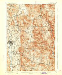
~ Rutland VT topo map, 1:62500 scale, 15 X 15 Minute, Historical, 1893, updated 1933
Rutland, Vermont, USGS topographic map dated 1893.
Includes geographic coordinates (latitude and longitude). This topographic map is suitable for hiking, camping, and exploring, or framing it as a wall map.
Printed on-demand using high resolution imagery, on heavy weight and acid free paper, or alternatively on a variety of synthetic materials.
Topos available on paper, Waterproof, Poly, or Tyvek. Usually shipping rolled, unless combined with other folded maps in one order.
- Product Number: USGS-5600530
- Free digital map download (high-resolution, GeoPDF): Rutland, Vermont (file size: 13 MB)
- Map Size: please refer to the dimensions of the GeoPDF map above
- Weight (paper map): ca. 55 grams
- Map Type: POD USGS Topographic Map
- Map Series: HTMC
- Map Verison: Historical
- Cell ID: 61866
- Scan ID: 338137
- Imprint Year: 1933
- Survey Year: 1891
- Datum: Unstated
- Map Projection: Polyconic
- Map published by United States Geological Survey
- Map Language: English
- Scanner Resolution: 600 dpi
- Map Cell Name: Rutland
- Grid size: 15 X 15 Minute
- Date on map: 1893
- Map Scale: 1:62500
- Geographical region: Vermont, United States
Neighboring Maps:
All neighboring USGS topo maps are available for sale online at a variety of scales.
Spatial coverage:
Topo map Rutland, Vermont, covers the geographical area associated the following places:
- Brookwood Estates - South Sherburne - Pinnacle Ridge - North Clarendon - Rutland - Brookside Trailer Park - North Sherburne - Eastridge Acres - Blue Ridge Acres - Green Acres - Killington Village - Killington - Heritage Hill Development - Marolin Acres - Brewers Corner - Colonial Estates - Bassett Development - Shrewsbury - Alfrecha - Pierces Corner - Telemark Village - Cold River - North Shrewsbury - Pinecrest Acres - Killington Heights - Chittenden - North Chittenden - Countryside Estates - Billings Mobile Manor - Clarendon - Chasanna Acres - Sugarwood Hill - East Clarendon - East Pittsford - Sherburne Center - The Woods - Mountain View Estates - Prospect Hill - Grandview Acres - Mendon
- Map Area ID: AREA43.7543.5-73-72.75
- Northwest corner Lat/Long code: USGSNW43.75-73
- Northeast corner Lat/Long code: USGSNE43.75-72.75
- Southwest corner Lat/Long code: USGSSW43.5-73
- Southeast corner Lat/Long code: USGSSE43.5-72.75
- Northern map edge Latitude: 43.75
- Southern map edge Latitude: 43.5
- Western map edge Longitude: -73
- Eastern map edge Longitude: -72.75


