
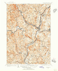
~ Hanover VT topo map, 1:62500 scale, 15 X 15 Minute, Historical, 1906, updated 1956
Hanover, Vermont, USGS topographic map dated 1906.
Includes geographic coordinates (latitude and longitude). This topographic map is suitable for hiking, camping, and exploring, or framing it as a wall map.
Printed on-demand using high resolution imagery, on heavy weight and acid free paper, or alternatively on a variety of synthetic materials.
Topos available on paper, Waterproof, Poly, or Tyvek. Usually shipping rolled, unless combined with other folded maps in one order.
- Product Number: USGS-5600278
- Free digital map download (high-resolution, GeoPDF): Hanover, Vermont (file size: 13 MB)
- Map Size: please refer to the dimensions of the GeoPDF map above
- Weight (paper map): ca. 55 grams
- Map Type: POD USGS Topographic Map
- Map Series: HTMC
- Map Verison: Historical
- Cell ID: 55049
- Scan ID: 337964
- Imprint Year: 1956
- Survey Year: 1906
- Datum: NAD27
- Map Projection: Polyconic
- Map published by United States Geological Survey
- Map Language: English
- Scanner Resolution: 600 dpi
- Map Cell Name: Hanover
- Grid size: 15 X 15 Minute
- Date on map: 1906
- Map Scale: 1:62500
- Geographical region: Vermont, United States
Neighboring Maps:
All neighboring USGS topo maps are available for sale online at a variety of scales.
Spatial coverage:
Topo map Hanover, Vermont, covers the geographical area associated the following places:
- Hartland - Hannahs Mobile Home Park - Jericho - Wilder - Mill Village - Squag City - Quechee - Centerville - East Wilder - North Hartland - Taftsville - Pinewood Village - Jenneville - Hanover - Bragg - Hewitts Corners - Lebanon - Millbrook - Sachem Village - North Pomfret - Fieldsville - West Hartford - Russtown - Plainfield - Olcot Falls Mobile Home Park - Centertown - Deweys Mills - Hartland Four Corners - Norwich - Oscars Mobile Home Park - Mill Hollow - Meadow Brook Village - Hartford - Rivercrest - West Lebanon - Lewiston - Hell Hollow - White River Junction - Dothan - Meriden
- Map Area ID: AREA43.7543.5-72.5-72.25
- Northwest corner Lat/Long code: USGSNW43.75-72.5
- Northeast corner Lat/Long code: USGSNE43.75-72.25
- Southwest corner Lat/Long code: USGSSW43.5-72.5
- Southeast corner Lat/Long code: USGSSE43.5-72.25
- Northern map edge Latitude: 43.75
- Southern map edge Latitude: 43.5
- Western map edge Longitude: -72.5
- Eastern map edge Longitude: -72.25


