
~ Ogden UT topo map, 1:250000 scale, 1 X 2 Degree, Historical, 1960
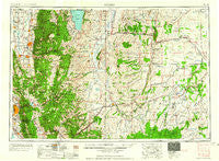
Ogden, Utah, USGS topographic map dated 1960.
Includes geographic coordinates (latitude and longitude). This topographic map is suitable for hiking, camping, and exploring, or framing it as a wall map.
Printed on-demand using high resolution imagery, on heavy weight and acid free paper, or alternatively on a variety of synthetic materials.
Topos available on paper, Waterproof, Poly, or Tyvek. Usually shipping rolled, unless combined with other folded maps in one order.
- Product Number: USGS-5463409
- Free digital map download (high-resolution, GeoPDF): Ogden, Utah (file size: 21 MB)
- Map Size: please refer to the dimensions of the GeoPDF map above
- Weight (paper map): ca. 55 grams
- Map Type: POD USGS Topographic Map
- Map Series: HTMC
- Map Verison: Historical
- Cell ID: 68944
- Scan ID: 251074
- Woodland Tint: Yes
- Aerial Photo Year: 1954
- Datum: Unstated
- Map Projection: Transverse Mercator
- Map published by United States Army Corps of Engineers
- Map published by United States Army
- Map Language: English
- Scanner Resolution: 600 dpi
- Map Cell Name: Ogden
- Grid size: 1 X 2 Degree
- Date on map: 1960
- Map Scale: 1:250000
- Geographical region: Utah, United States
Neighboring Maps:
All neighboring USGS topo maps are available for sale online at a variety of scales.
Spatial coverage:
Topo map Ogden, Utah, covers the geographical area associated the following places:
- Monterey Addition - Turf park - Church Hills - Uintah - Southridge Subdivision 6 - Fairfield Condominium - Indian Hills - White Addition - Chimes View Acres - Leedot Heights - Burch Creek Heights - Cherrywood Condominium - Shanna - Heath - Walker - Hi Vista - Paradise - Cottonwood - Lake View Terrace - Aspen Heights - Carters Farm - Millville - Hillcrest Addition - Florence Park Addition - North Logan - Dundee Place - Saunders - View Heights - Southridge Subdivision 3 - Rushton Addition - Wheat Ridge - Creekside Condominium - Victory Park - Palos Verde Estates - Mount Ogden Terrace Condominium Project - University Place Addition - Wolf Creek Village - Hods Hollow - South Washington Addition - Mount Sterling - Haven Park - Chokecherry Summer Home Area - River Heights - Wellsville - Oquirrh View - Scottish Highlands - Hill Top - Country Creek Estates - Vera Lee - Lake Hills - Blackburns - Country Estates - Riley - Causey Estates - Stones Orchard Addition - Oakridge Village - Green Mountain Estates - Hunting Creek - Sage - The Colony - Main Point South - Lyman - Southridge Subdivision 1 - Kimberly Meadows - Mendon - Golden View - City Park Addition - Rockcliff Addition - Eastwood Subdivision Number 7 - Oakmont Acres - East Park Addition - Whitesides Estates - Keystone Acres - Carole - Sundowner Condominium - El Monte Vista - Stevens - Hillside Estates - Bristol Mansion Condominium - River View Addition - The Heights Condominium - College Ward - Wooded Hills - Cherrywood - King Clarion Hills - Pleasant Hills - Camarren Cove Estates - Valley Terrace Condominium - De Bloois - Mountain Valley Meadows - South Weber - Canyon Terrace Condominium - Antelope - Emerald Hills Condominium - Croydon - Montrose Addition - Shannon Bee Estates - Country Oaks Condominium - Frontier - Paradise Acres
- Map Area ID: AREA4241-112-110
- Northwest corner Lat/Long code: USGSNW42-112
- Northeast corner Lat/Long code: USGSNE42-110
- Southwest corner Lat/Long code: USGSSW41-112
- Southeast corner Lat/Long code: USGSSE41-110
- Northern map edge Latitude: 42
- Southern map edge Latitude: 41
- Western map edge Longitude: -112
- Eastern map edge Longitude: -110


