
~ Moab UT topo map, 1:250000 scale, 1 X 2 Degree, Historical, 1956, updated 1972
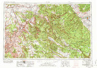
Moab, Utah, USGS topographic map dated 1956.
Includes geographic coordinates (latitude and longitude). This topographic map is suitable for hiking, camping, and exploring, or framing it as a wall map.
Printed on-demand using high resolution imagery, on heavy weight and acid free paper, or alternatively on a variety of synthetic materials.
Topos available on paper, Waterproof, Poly, or Tyvek. Usually shipping rolled, unless combined with other folded maps in one order.
- Product Number: USGS-5463390
- Free digital map download (high-resolution, GeoPDF): Moab, Utah (file size: 24 MB)
- Map Size: please refer to the dimensions of the GeoPDF map above
- Weight (paper map): ca. 55 grams
- Map Type: POD USGS Topographic Map
- Map Series: HTMC
- Map Verison: Historical
- Cell ID: 74991
- Scan ID: 250630
- Imprint Year: 1972
- Woodland Tint: Yes
- Visual Version Number: 2
- Aerial Photo Year: 1956
- Edit Year: 1969
- Datum: Unstated
- Map Projection: Transverse Mercator
- Map published by United States Geological Survey
- Map published by: Military, Other
- Map Language: English
- Scanner Resolution: 600 dpi
- Map Cell Name: Moab
- Grid size: 1 X 2 Degree
- Date on map: 1956
- Map Scale: 1:250000
- Geographical region: Utah, United States
Neighboring Maps:
All neighboring USGS topo maps are available for sale online at a variety of scales.
Spatial coverage:
Topo map Moab, Utah, covers the geographical area associated the following places:
- Leonard (historical) - Huff - Brendel - Basin - Hoovers Corner - Saunders - Whitewater - Glade Park - Old La Sal - Vista - Redvale - Delta - Bridgeport - Thompson Springs - Placerville - Nucla - Houser Cow Camp - Cisco - Escalante - Elba - Paradox - Pea Green Corner - Norwood - Piñon - East Vancorum - Mountain View - Gateway - Sagers - Kannah - West Vancorum - Bedrock - Peeples - Chipeta - Vancorum - Coventry - Spanish Valley - Uravan - Dewey - La Sal Junction - Ute - Naturita - Crescent Junction - Floy - Dominguez - Broughton - La Sal - North Delta - Moab - Beards Corner - Castle Valley - Keyhole
- Map Area ID: AREA3938-110-108
- Northwest corner Lat/Long code: USGSNW39-110
- Northeast corner Lat/Long code: USGSNE39-108
- Southwest corner Lat/Long code: USGSSW38-110
- Southeast corner Lat/Long code: USGSSE38-108
- Northern map edge Latitude: 39
- Southern map edge Latitude: 38
- Western map edge Longitude: -110
- Eastern map edge Longitude: -108


