
~ Ft Douglas UT topo map, 1:125000 scale, 30 X 30 Minute, Historical, 1925
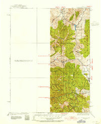
Ft Douglas, Utah, USGS topographic map dated 1925.
Includes geographic coordinates (latitude and longitude). This topographic map is suitable for hiking, camping, and exploring, or framing it as a wall map.
Printed on-demand using high resolution imagery, on heavy weight and acid free paper, or alternatively on a variety of synthetic materials.
Topos available on paper, Waterproof, Poly, or Tyvek. Usually shipping rolled, unless combined with other folded maps in one order.
- Product Number: USGS-5463261
- Free digital map download (high-resolution, GeoPDF): Ft Douglas, Utah (file size: 8 MB)
- Map Size: please refer to the dimensions of the GeoPDF map above
- Weight (paper map): ca. 55 grams
- Map Type: POD USGS Topographic Map
- Map Series: HTMC
- Map Verison: Historical
- Cell ID: 65500
- Scan ID: 249449
- Woodland Tint: Yes
- Survey Year: 1925
- Datum: NAD
- Map Projection: Polyconic
- Map published by United States Geological Survey
- Map Language: English
- Scanner Resolution: 600 dpi
- Map Cell Name: Fort Douglas
- Grid size: 30 X 30 Minute
- Date on map: 1925
- Map Scale: 1:125000
- Geographical region: Utah, United States
Neighboring Maps:
All neighboring USGS topo maps are available for sale online at a variety of scales.
Spatial coverage:
Topo map Ft Douglas, Utah, covers the geographical area associated the following places:
- Midland Five Acre Plat - Park Heights Condo - Cobblestone Village - Ponderosa Park - Pinegrove Estates - Sandra Way - Velbar - Cottonwood Hills Condo - Manor Estates - Mount Olympus Gardens Condominium - Hidden Hills - Hillside - Oakview Estates Subdivision Numbers 2,3 and 4 - Sunset Heights - Capitol Hill - Canyon Oak Village - Capitol Gardens Condominium - Layrelwood Estates - Olympus View - Summer Garden Townhouse Condominium - Carole Addition - Lemontree Condominium - Ballard Avenues - Noall - Silver Fork - Brighton Point - Willow Creek Estates - Harrisonwood Estates - Riviera Condo - Goldcrest - West Jordan - Panorama Acres - Heather Glen Condo - Steed Creek Estates - Farnsworth Condominium - Mountain Dell Park - Marion Village - Woodcreek Glen Condo - Sherwood Forest Addition - Daysen Heights - Willows Condominium - Heather Circle - Campbell - Lampton Farms - South Church Heights - Ellison Woods - Pebble Springs Estates - New England Condominium - Valley Heights Twin Home Condo - Silver Mountain Estates - Ensign Downs Place - Willow Creek Terrace - Victoria Place - Easton in Holladay Condominium - Coventry Manor Condominium - Hyland Lake - Cloverland Estates - Randall Way - Dublin Town - Jordan Hills Estates - Stansbury - Haven Grove - Castlefield Downs - Willow Creek Meadows - Glendale Park Plat A East - The Maryland Condominium - Pedersen - North Shadow Mountain Estates - Granite Mesa - Blackjack Village Condominiums - Pepperwood Terrace - The Pines - Woodmere - Sandy Heights South - Farm Hill - River Crest - Valley View - Holland - Calann - Highlands of Hidden Valley - Spring Creek Manor - Greenfield Village - Altawood Place - Jordan Addition - Ridgecrest - Mavis - East Rubens - Oakvista Park - Val De Neige - Valley Crest Estates - Hilltop Gardens - Mingo Park - Thomas - Meadowbrook Valley - Marmalade Condominium - South Cottonwood Acres - Willow Place - Telford - Val Vista - Park Central
- Map Area ID: AREA4140.5-112-111.5
- Northwest corner Lat/Long code: USGSNW41-112
- Northeast corner Lat/Long code: USGSNE41-111.5
- Southwest corner Lat/Long code: USGSSW40.5-112
- Southeast corner Lat/Long code: USGSSE40.5-111.5
- Northern map edge Latitude: 41
- Southern map edge Latitude: 40.5
- Western map edge Longitude: -112
- Eastern map edge Longitude: -111.5


