
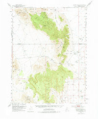
~ Dugway Range UT topo map, 1:62500 scale, 15 X 15 Minute, Historical, 1953, updated 1975
Dugway Range, Utah, USGS topographic map dated 1953.
Includes geographic coordinates (latitude and longitude). This topographic map is suitable for hiking, camping, and exploring, or framing it as a wall map.
Printed on-demand using high resolution imagery, on heavy weight and acid free paper, or alternatively on a variety of synthetic materials.
Topos available on paper, Waterproof, Poly, or Tyvek. Usually shipping rolled, unless combined with other folded maps in one order.
- Product Number: USGS-5462387
- Free digital map download (high-resolution, GeoPDF): Dugway Range, Utah (file size: 7 MB)
- Map Size: please refer to the dimensions of the GeoPDF map above
- Weight (paper map): ca. 55 grams
- Map Type: POD USGS Topographic Map
- Map Series: HTMC
- Map Verison: Historical
- Cell ID: 53581
- Scan ID: 249026
- Imprint Year: 1975
- Woodland Tint: Yes
- Aerial Photo Year: 1951
- Survey Year: 1953
- Datum: NAD27
- Map Projection: Polyconic
- Map published by United States Geological Survey
- Map Language: English
- Scanner Resolution: 600 dpi
- Map Cell Name: Dugway Range
- Grid size: 15 X 15 Minute
- Date on map: 1953
- Map Scale: 1:62500
- Geographical region: Utah, United States
Neighboring Maps:
All neighboring USGS topo maps are available for sale online at a variety of scales.
Spatial coverage:
Topo map Dugway Range, Utah, covers the geographical area associated the following places:
- Pismire Knolls - Rainbow Mines - Dugway Pass - Bittner Knoll Reservoir - Fera Number 38 Well - Goshoot Canyon - Cannon Mine - Fandangle Canyon - Four Metal Mine - North Fork Pismire Wash - East Topaz 2 Reservoir - Dugway Range - Hangrock Spring - Pyramid Peak - Green Grass Valley - South Fork Pismire Wash - Shadscale Canyon - Blowout Mine - Engelmann Canyon - Hanauer Ridge - Thursday Mine - Monument Reservoir - Dugway Ridge - Thomas Ridge - Hilltop Mine - Wildhorse Spring - Dugway Topaz Well - Kellys Hole - Buckhorn Canyon - Castle Mountain - Geode Beds - Well Number 28 - Fera Canyon - Gilson Canyon - Fandangle Well - Straight Canyon - Oversight Mine - Colored Pass - Dugway Pony Express Station - Trailer Wash - Shadscale Canyon Trailer Wash - Bittner Knoll - Cannon Canyon
- Map Area ID: AREA4039.75-113.25-113
- Northwest corner Lat/Long code: USGSNW40-113.25
- Northeast corner Lat/Long code: USGSNE40-113
- Southwest corner Lat/Long code: USGSSW39.75-113.25
- Southeast corner Lat/Long code: USGSSE39.75-113
- Northern map edge Latitude: 40
- Southern map edge Latitude: 39.75
- Western map edge Longitude: -113.25
- Eastern map edge Longitude: -113


