
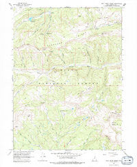
~ Wolf Creek Summit UT topo map, 1:24000 scale, 7.5 X 7.5 Minute, Historical, 1967, updated 1979
Wolf Creek Summit, Utah, USGS topographic map dated 1967.
Includes geographic coordinates (latitude and longitude). This topographic map is suitable for hiking, camping, and exploring, or framing it as a wall map.
Printed on-demand using high resolution imagery, on heavy weight and acid free paper, or alternatively on a variety of synthetic materials.
Topos available on paper, Waterproof, Poly, or Tyvek. Usually shipping rolled, unless combined with other folded maps in one order.
- Product Number: USGS-5462105
- Free digital map download (high-resolution, GeoPDF): Wolf Creek Summit, Utah (file size: 12 MB)
- Map Size: please refer to the dimensions of the GeoPDF map above
- Weight (paper map): ca. 55 grams
- Map Type: POD USGS Topographic Map
- Map Series: HTMC
- Map Verison: Historical
- Cell ID: 49649
- Scan ID: 252834
- Imprint Year: 1979
- Woodland Tint: Yes
- Aerial Photo Year: 1963
- Field Check Year: 1967
- Datum: NAD27
- Map Projection: Polyconic
- Map Language: English
- Scanner Resolution: 600 dpi
- Map Cell Name: Wolf Creek Summit
- Grid size: 7.5 X 7.5 Minute
- Date on map: 1967
- Map Scale: 1:24000
- Geographical region: Utah, United States
Neighboring Maps:
All neighboring USGS topo maps are available for sale online at a variety of scales.
Spatial coverage:
Topo map Wolf Creek Summit, Utah, covers the geographical area associated the following places:
- Sandstone Basin - Buck Knoll - Corral Hollow - Mill Hollow Campground - Wolf Creek Peak - Mill Hollow Granite School Center - Mill Hollow Reservoir - Jimmies Basin - Heart Lake - Shale Ridge - Vat Creek - Duchesne Ridge - Mill Hollow Dam - Death Hollow - Becky Basin - Pass Creek - Red Creek Mountain - Coleman Basin - Low Pass - Jones Basin - Camp Hollow - Washout Gulch - Mill Hollow Guard Station - Yellow Lake - Neeley Basin - Scotty Basin - Beef Pasture - East Fork Mill Hollow - Trail Hollow - Vat Creek Ridge - White Ledge - Wolf Creek Campground - Telephone Hollow - Little West Fork - Campbell Hollow - Bills Basin - Vat Tunnel - Coyote Ridge - Wolf Creek Summit
- Map Area ID: AREA40.540.375-111.125-111
- Northwest corner Lat/Long code: USGSNW40.5-111.125
- Northeast corner Lat/Long code: USGSNE40.5-111
- Southwest corner Lat/Long code: USGSSW40.375-111.125
- Southeast corner Lat/Long code: USGSSE40.375-111
- Northern map edge Latitude: 40.5
- Southern map edge Latitude: 40.375
- Western map edge Longitude: -111.125
- Eastern map edge Longitude: -111


