
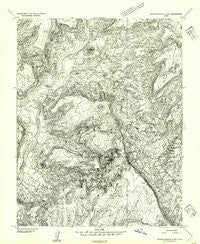
~ White Canyon 3 NW UT topo map, 1:24000 scale, 7.5 X 7.5 Minute, Historical, 1954, updated 1954
White Canyon 3 NW, Utah, USGS topographic map dated 1954.
Includes geographic coordinates (latitude and longitude). This topographic map is suitable for hiking, camping, and exploring, or framing it as a wall map.
Printed on-demand using high resolution imagery, on heavy weight and acid free paper, or alternatively on a variety of synthetic materials.
Topos available on paper, Waterproof, Poly, or Tyvek. Usually shipping rolled, unless combined with other folded maps in one order.
- Product Number: USGS-5461939
- Free digital map download (high-resolution, GeoPDF): White Canyon 3 NW, Utah (file size: 14 MB)
- Map Size: please refer to the dimensions of the GeoPDF map above
- Weight (paper map): ca. 55 grams
- Map Type: POD USGS Topographic Map
- Map Series: HTMC
- Map Verison: Historical
- Cell ID: 17689
- Scan ID: 252735
- Imprint Year: 1954
- Aerial Photo Year: 1951
- Datum: Unstated
- Map Projection: Unstated
- Preliminary map: Yes
- Map published by United States Geological Survey
- Keywords: Nonstandard Press Run
- Map Language: English
- Scanner Resolution: 600 dpi
- Map Cell Name: Good Hope Bay
- Grid size: 7.5 X 7.5 Minute
- Date on map: 1954
- Map Scale: 1:24000
- Geographical region: Utah, United States
Neighboring Maps:
All neighboring USGS topo maps are available for sale online at a variety of scales.
Spatial coverage:
Topo map White Canyon 3 NW, Utah, covers the geographical area associated the following places:
- Rainbow Canyon - Castle Butte - Kathys Canyon - Wilson Canyon - Rainbow Canyon - Blue Canyon - Hidden Valley - Blue Notch Canyon - Little Rincon - Wilson Canyon - The Rincon - Warm Spring - Ticaboo Creek - Mahon Canyon - Popcorn Canyon - Good Hope Bay - Red Canyon - Ticaboo Number 1 Rapids - Bessie Bar (historical) - Monte Cristo Island - Sandstone Knolls - Ticaboo Number 2 Rapids
- Map Area ID: AREA37.7537.625-110.5-110.375
- Northwest corner Lat/Long code: USGSNW37.75-110.5
- Northeast corner Lat/Long code: USGSNE37.75-110.375
- Southwest corner Lat/Long code: USGSSW37.625-110.5
- Southeast corner Lat/Long code: USGSSE37.625-110.375
- Northern map edge Latitude: 37.75
- Southern map edge Latitude: 37.625
- Western map edge Longitude: -110.5
- Eastern map edge Longitude: -110.375


