
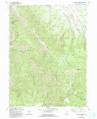
~ Wallsburg Ridge UT topo map, 1:24000 scale, 7.5 X 7.5 Minute, Historical, 1993, updated 1993
Wallsburg Ridge, Utah, USGS topographic map dated 1993.
Includes geographic coordinates (latitude and longitude). This topographic map is suitable for hiking, camping, and exploring, or framing it as a wall map.
Printed on-demand using high resolution imagery, on heavy weight and acid free paper, or alternatively on a variety of synthetic materials.
Topos available on paper, Waterproof, Poly, or Tyvek. Usually shipping rolled, unless combined with other folded maps in one order.
- Product Number: USGS-5461793
- Free digital map download (high-resolution, GeoPDF): Wallsburg Ridge, Utah (file size: 17 MB)
- Map Size: please refer to the dimensions of the GeoPDF map above
- Weight (paper map): ca. 55 grams
- Map Type: POD USGS Topographic Map
- Map Series: HTMC
- Map Verison: Historical
- Cell ID: 76676
- Scan ID: 252639
- Imprint Year: 1993
- Woodland Tint: Yes
- Aerial Photo Year: 1987
- Edit Year: 1993
- Field Check Year: 1990
- Datum: NAD27
- Map Projection: Lambert Conformal Conic
- Map published by United States Geological Survey
- Map Language: English
- Scanner Resolution: 600 dpi
- Map Cell Name: Wallsburg Ridge
- Grid size: 7.5 X 7.5 Minute
- Date on map: 1993
- Map Scale: 1:24000
- Geographical region: Utah, United States
Neighboring Maps:
All neighboring USGS topo maps are available for sale online at a variety of scales.
Spatial coverage:
Topo map Wallsburg Ridge, Utah, covers the geographical area associated the following places:
- Wallsburg Ridge - Balsam Creek - Whipstock Creek - Bear Canyon Pass - Penrod Creek - Slide Hollow - Johns Glen - Balsam Bench - Right Fork Little Hobble Creek - Schoolhouse Creek - Maple Creek - Slipper Hollow - Left Fork Little Hobble Creek - Main Canyon - Boren Ditch - Fullmer Hollow - Smooth Hollow - Packard Canyon - Rock Slide Canyon - Wing Flat - The Narrows - Rattlesnake Mountain - Maple Canyon - Warm Spring - Little Valley - Sheep Canyon - Bald Knoll - Soldier Bench
- Map Area ID: AREA40.37540.25-111.5-111.375
- Northwest corner Lat/Long code: USGSNW40.375-111.5
- Northeast corner Lat/Long code: USGSNE40.375-111.375
- Southwest corner Lat/Long code: USGSSW40.25-111.5
- Southeast corner Lat/Long code: USGSSE40.25-111.375
- Northern map edge Latitude: 40.375
- Southern map edge Latitude: 40.25
- Western map edge Longitude: -111.5
- Eastern map edge Longitude: -111.375


