
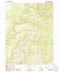
~ Sunset Peak UT topo map, 1:24000 scale, 7.5 X 7.5 Minute, Historical, 1986, updated 1986
Sunset Peak, Utah, USGS topographic map dated 1986.
Includes geographic coordinates (latitude and longitude). This topographic map is suitable for hiking, camping, and exploring, or framing it as a wall map.
Printed on-demand using high resolution imagery, on heavy weight and acid free paper, or alternatively on a variety of synthetic materials.
Topos available on paper, Waterproof, Poly, or Tyvek. Usually shipping rolled, unless combined with other folded maps in one order.
- Product Number: USGS-5461229
- Free digital map download (high-resolution, GeoPDF): Sunset Peak, Utah (file size: 15 MB)
- Map Size: please refer to the dimensions of the GeoPDF map above
- Weight (paper map): ca. 55 grams
- Map Type: POD USGS Topographic Map
- Map Series: HTMC
- Map Verison: Historical
- Cell ID: 43866
- Scan ID: 252206
- Imprint Year: 1986
- Woodland Tint: Yes
- Aerial Photo Year: 1981
- Edit Year: 1986
- Field Check Year: 1982
- Datum: NAD27
- Map Projection: Lambert Conformal Conic
- Provisional map: Yes
- Map published by United States Geological Survey
- Map Language: English
- Scanner Resolution: 600 dpi
- Map Cell Name: Sunset Peak
- Grid size: 7.5 X 7.5 Minute
- Date on map: 1986
- Map Scale: 1:24000
- Geographical region: Utah, United States
Neighboring Maps:
All neighboring USGS topo maps are available for sale online at a variety of scales.
Spatial coverage:
Topo map Sunset Peak, Utah, covers the geographical area associated the following places:
- Huncup Creek - Mortensen Spring - Big Cottonwood Canyon - Walker Spring - East Fork Corn Creek - Leavitts Canyon - First Creek - Adelaide Campground - Sunset Canyon - Misery Creek - Indian Spring - Hell Hole Canyon - North Fork Kanosh Canyon - Sunset Peak - North Fork Corn Creek - Woolsey Ridge - Mine Camp Peak - Leavitts Peak - Cherry Creek - Crazy Hollow - West Fork Corn Creek - Monk Spring - Mortensen Canyon - Crazy Hollow Spring - Leavitts Spring - The Devils Armchair - North Fork Meadow Creek
- Map Area ID: AREA38.87538.75-112.375-112.25
- Northwest corner Lat/Long code: USGSNW38.875-112.375
- Northeast corner Lat/Long code: USGSNE38.875-112.25
- Southwest corner Lat/Long code: USGSSW38.75-112.375
- Southeast corner Lat/Long code: USGSSE38.75-112.25
- Northern map edge Latitude: 38.875
- Southern map edge Latitude: 38.75
- Western map edge Longitude: -112.375
- Eastern map edge Longitude: -112.25


