
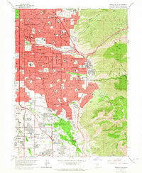
~ Sugar House UT topo map, 1:24000 scale, 7.5 X 7.5 Minute, Historical, 1963, updated 1964
Sugar House, Utah, USGS topographic map dated 1963.
Includes geographic coordinates (latitude and longitude). This topographic map is suitable for hiking, camping, and exploring, or framing it as a wall map.
Printed on-demand using high resolution imagery, on heavy weight and acid free paper, or alternatively on a variety of synthetic materials.
Topos available on paper, Waterproof, Poly, or Tyvek. Usually shipping rolled, unless combined with other folded maps in one order.
- Product Number: USGS-5461195
- Free digital map download (high-resolution, GeoPDF): Sugar House, Utah (file size: 15 MB)
- Map Size: please refer to the dimensions of the GeoPDF map above
- Weight (paper map): ca. 55 grams
- Map Type: POD USGS Topographic Map
- Map Series: HTMC
- Map Verison: Historical
- Cell ID: 43619
- Scan ID: 252179
- Imprint Year: 1964
- Woodland Tint: Yes
- Aerial Photo Year: 1962
- Field Check Year: 1963
- Survey Year: 1934
- Datum: NAD27
- Map Projection: Polyconic
- Map published by United States Geological Survey
- Map Language: English
- Scanner Resolution: 600 dpi
- Map Cell Name: Sugar House
- Grid size: 7.5 X 7.5 Minute
- Date on map: 1963
- Map Scale: 1:24000
- Geographical region: Utah, United States
Neighboring Maps:
All neighboring USGS topo maps are available for sale online at a variety of scales.
Spatial coverage:
Topo map Sugar House, Utah, covers the geographical area associated the following places:
- Holladay Gardens - Willes - Akron - Lincoln Manor Condominium - Sycamore Gardens - Dover Hill Condominium - Wagstaff Acres - Startup - Sears Addition - Wren Lane West - Fairbrook Condominium - Bonnie Brae - Yalecrest Heights - Cottonwood Hills - Holiday Center Addition - Whitaker - Yalecroft - Spring Creek Estates - Edgewood Estates - Bowthorpe - The Cottonwood Condominium - Haven Grove - Old Colony - Waterbury Condominium - Mount Athena - Castro Heoghts - Standia - Bev Wood Estates - Ute Circle - Lakewood - Stev Linda - Monte Carlo Condominium - Green Valley - Johnson - Ethel Gardens - Heughs Canyon - Canyon Cove - Jamestown - El Rancho - North Holladay - Wasatch Village Two and Three - Erekson Dairy - Windsor Circle - Southwood Two - Orchard Gardens - Quailbrook East Condominium - Valley View - Brookside Park - Sullivan Acres - Bellwood Acres - Cresthill Circle - Tidewater Village Condominium - Peony Gardens - Blue Grass Acres - Del Ann - Milo - Andlor - Mandalay Terrace - Arbor Estates - Cambria Pines - Casto Gardens - Southwood Three and Four - Hillside Village - Convest - The Cottonwoods Condominium - Floribunda Heights - Wilson - Shalamar - Elm Wood - Woodridge - Suncrest Park - Brockwood - Easton in Holladay Condominium - Biscayne Park - Springtree Condominium - Yale Heights - Spring Run - Three Fountains Manor House Condominium - Broadbent - Blackburn - Bron Breck - Locust Grove - Tall Oaks - White Circle - Powell Circle - Manor Estates - Brimley - Driftwood Estates - Hamilton Village - Three Fountains Young American Family Condominium - Wren Circle Condominium - Knight - Sleepy Hollow - Oakcrest - East Olympus Heights - Callister - Yalecrest Park - Crus - Bee and Gee - Kellgreen Acres
- Map Area ID: AREA40.7540.625-111.875-111.75
- Northwest corner Lat/Long code: USGSNW40.75-111.875
- Northeast corner Lat/Long code: USGSNE40.75-111.75
- Southwest corner Lat/Long code: USGSSW40.625-111.875
- Southeast corner Lat/Long code: USGSSE40.625-111.75
- Northern map edge Latitude: 40.75
- Southern map edge Latitude: 40.625
- Western map edge Longitude: -111.875
- Eastern map edge Longitude: -111.75


