
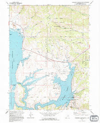
~ Strawberry Reservoir NE UT topo map, 1:24000 scale, 7.5 X 7.5 Minute, Historical, 1994, updated 1994
Strawberry Reservoir NE, Utah, USGS topographic map dated 1994.
Includes geographic coordinates (latitude and longitude). This topographic map is suitable for hiking, camping, and exploring, or framing it as a wall map.
Printed on-demand using high resolution imagery, on heavy weight and acid free paper, or alternatively on a variety of synthetic materials.
Topos available on paper, Waterproof, Poly, or Tyvek. Usually shipping rolled, unless combined with other folded maps in one order.
- Product Number: USGS-5461149
- Free digital map download (high-resolution, GeoPDF): Strawberry Reservoir NE, Utah (file size: 15 MB)
- Map Size: please refer to the dimensions of the GeoPDF map above
- Weight (paper map): ca. 55 grams
- Map Type: POD USGS Topographic Map
- Map Series: HTMC
- Map Verison: Historical
- Cell ID: 43472
- Scan ID: 252148
- Imprint Year: 1994
- Woodland Tint: Yes
- Aerial Photo Year: 1987
- Edit Year: 1994
- Field Check Year: 1990
- Datum: NAD27
- Map Projection: Lambert Conformal Conic
- Map published by United States Geological Survey
- Map Language: English
- Scanner Resolution: 600 dpi
- Map Cell Name: Strawberry Reservoir NE
- Grid size: 7.5 X 7.5 Minute
- Date on map: 1994
- Map Scale: 1:24000
- Geographical region: Utah, United States
Neighboring Maps:
All neighboring USGS topo maps are available for sale online at a variety of scales.
Spatial coverage:
Topo map Strawberry Reservoir NE, Utah, covers the geographical area associated the following places:
- Strawberry Dam (historical) - Soldier Creek Dam Day Use Area - Soldier Springs - Island Mountain - Road Hollow - Sage Creek - Stinking Springs - Windy Ridge - Pine Hollow - The Narrows - Coal Canyon - Badger Hollow - Soldier Creek Campground - Uintah and Ouray Division - Cow Hollow - Soldier Creek - Sage Creek Fisherman Access - Square Top Mountain - Badger Point Campground - Soldier Creek Bay Fisherman Access - Chipman Creek - West Portal Fisherman Access - Soldier Creek Recreation Complex - Green Knoll - Diving Rock Fisherman Access - Soldier Creek Overlook - Chicken Spring - Soldier Creek Reservoir - Water Hollow Tunnel - West Portal Water Hollow Tunnel - Soldier Creek Campground Loop Trail - Trout Creek - Soldier Creek Dam - Strawberry River Day Use Area
- Map Area ID: AREA40.2540.125-111.125-111
- Northwest corner Lat/Long code: USGSNW40.25-111.125
- Northeast corner Lat/Long code: USGSNE40.25-111
- Southwest corner Lat/Long code: USGSSW40.125-111.125
- Southeast corner Lat/Long code: USGSSE40.125-111
- Northern map edge Latitude: 40.25
- Southern map edge Latitude: 40.125
- Western map edge Longitude: -111.125
- Eastern map edge Longitude: -111


