
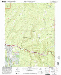
~ Steves Mountain UT topo map, 1:24000 scale, 7.5 X 7.5 Minute, Historical, 2001, updated 2003
Steves Mountain, Utah, USGS topographic map dated 2001.
Includes geographic coordinates (latitude and longitude). This topographic map is suitable for hiking, camping, and exploring, or framing it as a wall map.
Printed on-demand using high resolution imagery, on heavy weight and acid free paper, or alternatively on a variety of synthetic materials.
Topos available on paper, Waterproof, Poly, or Tyvek. Usually shipping rolled, unless combined with other folded maps in one order.
- Product Number: USGS-5461083
- Free digital map download (high-resolution, GeoPDF): Steves Mountain, Utah (file size: 14 MB)
- Map Size: please refer to the dimensions of the GeoPDF map above
- Weight (paper map): ca. 55 grams
- Map Type: POD USGS Topographic Map
- Map Series: HTMC
- Map Verison: Historical
- Cell ID: 43166
- Scan ID: 252099
- Imprint Year: 2003
- Woodland Tint: Yes
- Aerial Photo Year: 1999
- Datum: NAD27
- Map Projection: Lambert Conformal Conic
- Map published by United States Geological Survey
- Map published by United States Forest Service
- Map Language: English
- Scanner Resolution: 600 dpi
- Map Cell Name: Steves Mountain
- Grid size: 7.5 X 7.5 Minute
- Date on map: 2001
- Map Scale: 1:24000
- Geographical region: Utah, United States
Neighboring Maps:
All neighboring USGS topo maps are available for sale online at a variety of scales.
Spatial coverage:
Topo map Steves Mountain, Utah, covers the geographical area associated the following places:
- Water Hollow - Mud Spring - Oak Belt Trail - Sawtooth - Coal Hollow - Anthony Flat - Dead Horse Canyon - Beanies Hole - Steves Basin - Salina Division - Bear Gulch - Steves Pass - Alumbed Hollow - Bull Valley Mountain - Browns Hole - Cottonwood Creek - Maple Spring Canyon - Steves Mountain - Cedar Mountain
- Map Area ID: AREA3938.875-111.75-111.625
- Northwest corner Lat/Long code: USGSNW39-111.75
- Northeast corner Lat/Long code: USGSNE39-111.625
- Southwest corner Lat/Long code: USGSSW38.875-111.75
- Southeast corner Lat/Long code: USGSSE38.875-111.625
- Northern map edge Latitude: 39
- Southern map edge Latitude: 38.875
- Western map edge Longitude: -111.75
- Eastern map edge Longitude: -111.625


