
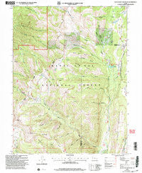
~ South Tent Mountain UT topo map, 1:24000 scale, 7.5 X 7.5 Minute, Historical, 2001, updated 2004
South Tent Mountain, Utah, USGS topographic map dated 2001.
Includes geographic coordinates (latitude and longitude). This topographic map is suitable for hiking, camping, and exploring, or framing it as a wall map.
Printed on-demand using high resolution imagery, on heavy weight and acid free paper, or alternatively on a variety of synthetic materials.
Topos available on paper, Waterproof, Poly, or Tyvek. Usually shipping rolled, unless combined with other folded maps in one order.
- Product Number: USGS-5460919
- Free digital map download (high-resolution, GeoPDF): South Tent Mountain, Utah (file size: 16 MB)
- Map Size: please refer to the dimensions of the GeoPDF map above
- Weight (paper map): ca. 55 grams
- Map Type: POD USGS Topographic Map
- Map Series: HTMC
- Map Verison: Historical
- Cell ID: 42302
- Scan ID: 251985
- Imprint Year: 2004
- Woodland Tint: Yes
- Aerial Photo Year: 1997
- Datum: NAD27
- Map Projection: Lambert Conformal Conic
- Map published by United States Geological Survey
- Map published by United States Forest Service
- Map Language: English
- Scanner Resolution: 600 dpi
- Map Cell Name: South Tent Mountain
- Grid size: 7.5 X 7.5 Minute
- Date on map: 2001
- Map Scale: 1:24000
- Geographical region: Utah, United States
Neighboring Maps:
All neighboring USGS topo maps are available for sale online at a variety of scales.
Spatial coverage:
Topo map South Tent Mountain, Utah, covers the geographical area associated the following places:
- Mountain Tunnel - Sheep Flat - Buck Basin - Bacon Rind Canyon - Potters Canyon - Browns Canyon - Black Canyon - Elizas Fork - Manti National Forest - Spring City Tunnel - Middle Mountain - Hogan Basin - Potters Pond Number One Dam - Spring City Ditch - North Tent Mountain - Potters Canyon Ditch - Potters Pond Number Two Dam - Brough Fork - Lost Basin - Fly Canyon - Potters Ponds - Lowry Top - Red Pine Cove - South Tent Mountain - Dry Canyon - Bulger Ridge - Little Buck Basin - Booths Canyon - Becks Cabin - Mill Canyon - Soren Peterson Meadow - Cedar Creek Tunnel - Scad Valley Divide - Cow Fork - Bennetts Canyon - Meadow Fork - Mountain Tunnel Ditch - Black Canyon - Little Mountain - Bulger Canyon - Bacon Rind Ridge
- Map Area ID: AREA39.539.375-111.375-111.25
- Northwest corner Lat/Long code: USGSNW39.5-111.375
- Northeast corner Lat/Long code: USGSNE39.5-111.25
- Southwest corner Lat/Long code: USGSSW39.375-111.375
- Southeast corner Lat/Long code: USGSSE39.375-111.25
- Northern map edge Latitude: 39.5
- Southern map edge Latitude: 39.375
- Western map edge Longitude: -111.375
- Eastern map edge Longitude: -111.25


