
~ Salt Lake City North UT topo map, 1:24000 scale, 7.5 X 7.5 Minute, Historical, 1963, updated 1978
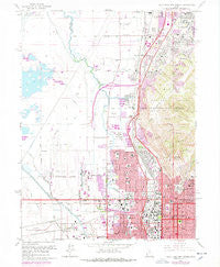
Salt Lake City North, Utah, USGS topographic map dated 1963.
Includes geographic coordinates (latitude and longitude). This topographic map is suitable for hiking, camping, and exploring, or framing it as a wall map.
Printed on-demand using high resolution imagery, on heavy weight and acid free paper, or alternatively on a variety of synthetic materials.
Topos available on paper, Waterproof, Poly, or Tyvek. Usually shipping rolled, unless combined with other folded maps in one order.
- Product Number: USGS-5460505
- Free digital map download (high-resolution, GeoPDF): Salt Lake City North, Utah (file size: 13 MB)
- Map Size: please refer to the dimensions of the GeoPDF map above
- Weight (paper map): ca. 55 grams
- Map Type: POD USGS Topographic Map
- Map Series: HTMC
- Map Verison: Historical
- Cell ID: 71500
- Scan ID: 251652
- Imprint Year: 1978
- Woodland Tint: Yes
- Photo Revision Year: 1975
- Aerial Photo Year: 1975
- Field Check Year: 1963
- Survey Year: 1951
- Datum: NAD27
- Map Projection: Polyconic
- Map published by United States Geological Survey
- Map Language: English
- Scanner Resolution: 600 dpi
- Map Cell Name: Salt Lake City North
- Grid size: 7.5 X 7.5 Minute
- Date on map: 1963
- Map Scale: 1:24000
- Geographical region: Utah, United States
Neighboring Maps:
All neighboring USGS topo maps are available for sale online at a variety of scales.
Spatial coverage:
Topo map Salt Lake City North, Utah, covers the geographical area associated the following places:
- Normandy Park - S and D - Sycamore - Colorado - Heaths Blocks 39 and 40 - Talisman Drive - Sherwood Forest Addition - Orson Ellis - Jennings North Salt Lake - Rustic Acres - The Villa Granade Condominium - Bona Vista - Thompsons - North Temple Street - Betty Manor - Hot Springs - Burlington Addition East - Tara Condominium - Cone and Roberts Addition - Fairfield - Meadow Crossing - North Salt Lake - Marsden - Wilkes - Wall Street Condominium - Beverly Addition - Mar Vista - Folsons Addition - McIntyre Building Condominium - Buena Vista - Kabis and Myers - Oakleaf - Gateway Condominium - Martins - Skyline Park - Jones - Williamsburgh - Geurts - Rainbow Hills - Summer Garden Townhouse Condominium - Valley Side - Jordan Place - Colonial Square - Capitol Heights Condominium - Wright Circle - Sunshine - Earl D Grays - Buena Vista - Irving Park Addition - Woods Cross - Deskys Addition Five - Maryan Estates - Woodland Gardens - Coates and Corums - Butte - Chalet - Irfred Park - Garden Grove - The Mills - Briarwood Acres - Rose Park - Woodland - Polaris Gardens Condominium - Kimball Condominium - Linda Loma Acres - Orchard Acres - Northpoint Estates Condominium - Deseret - Brown - Poplar Place - Featherstone - Rock Springs - Wilkinsons - Highland Park Addition - North Crest Park Condominium - Val Verda Heights - Deskys - Spring Meadow - North Point Cove - Robinvale Estates - Maach Addition - Doull Brothers - Greenbriar Condominiums - Brown Stone Condominium - Canyon Road Towers Condominium - Oxford Manor Condominium - Boulton - Co Rae - Golden Park - Amos Addition - Vineyard Condominium - Oakley - Orchard Hills East - Marmalade Condominium - Villa Montaige Condominium - Stanley Circle - Jenkins Orchard - Denver City - Harbor Heights - South Valley View
- Map Area ID: AREA40.87540.75-112-111.875
- Northwest corner Lat/Long code: USGSNW40.875-112
- Northeast corner Lat/Long code: USGSNE40.875-111.875
- Southwest corner Lat/Long code: USGSSW40.75-112
- Southeast corner Lat/Long code: USGSSE40.75-111.875
- Northern map edge Latitude: 40.875
- Southern map edge Latitude: 40.75
- Western map edge Longitude: -112
- Eastern map edge Longitude: -111.875


