
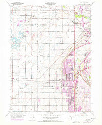
~ Roy UT topo map, 1:24000 scale, 7.5 X 7.5 Minute, Historical, 1955, updated 1978
Roy, Utah, USGS topographic map dated 1955.
Includes geographic coordinates (latitude and longitude). This topographic map is suitable for hiking, camping, and exploring, or framing it as a wall map.
Printed on-demand using high resolution imagery, on heavy weight and acid free paper, or alternatively on a variety of synthetic materials.
Topos available on paper, Waterproof, Poly, or Tyvek. Usually shipping rolled, unless combined with other folded maps in one order.
- Product Number: USGS-5460423
- Free digital map download (high-resolution, GeoPDF): Roy, Utah (file size: 11 MB)
- Map Size: please refer to the dimensions of the GeoPDF map above
- Weight (paper map): ca. 55 grams
- Map Type: POD USGS Topographic Map
- Map Series: HTMC
- Map Verison: Historical
- Cell ID: 38825
- Scan ID: 251593
- Imprint Year: 1978
- Woodland Tint: Yes
- Photo Revision Year: 1975
- Aerial Photo Year: 1975
- Survey Year: 1955
- Datum: NAD27
- Map Projection: Polyconic
- Map published by United States Geological Survey
- Map published by United States Army Corps of Engineers
- Map Language: English
- Scanner Resolution: 600 dpi
- Map Cell Name: Roy
- Grid size: 7.5 X 7.5 Minute
- Date on map: 1955
- Map Scale: 1:24000
- Geographical region: Utah, United States
Neighboring Maps:
All neighboring USGS topo maps are available for sale online at a variety of scales.
Spatial coverage:
Topo map Roy, Utah, covers the geographical area associated the following places:
- Arsenal Villa - Wen Dale Park - Roy West - Westbrook - Westlake Village - El Centro Estates - Kingsville Junction - Sandalwood Square - Hill Acres - Lewis Estates - Buena Vista - Meadowlane - Rosewood Manor Condominium - Richton Ranchettes - Country Homes - Jackson Orchards - Hooper - Lazy L Estates - Linda Vista - Terry Estates - New Hampton Manor - West View Park - Scotts Dale - Lakeview Equestrian Park - Heritage Square - Roi-Dell - Parker - Hatch - Marriott - Alpine Ranchettes - Margretta - Shannondoah Estates - Jones - Mansion Heights Addition - Maybrook - Clinton - Harmony Park - Interwest Condominium Project Phase A - Marianne Condominium - Montrose Park - Fawcett - Fowers - Donita - William R Patterson - Marvins - Parkside - Anderson West Acres - Carriage Lane Number Two - C C Ann Estates - Mitchell Estates - West Weber - Country Meadows - Holley and Whitney - Alpine Ranchettes Two - Tubbs - Kelley Kay Acres - Fuit - Valleywest - Taylor - Lawndale Addition - Pinto Acres - Burmont Park - Farr Number Two - Wheatridge Estates - Clays Ranchettes - Bonham - Graig Dale - Arthur Jones Estate - Lakeside Park - Apple Park - Loma Bonita - Foxglen - Midland Square - Suburban Heights - Parks - Coy - Lakeside Acres - Commonwealth Square Condominium - Valley Park Estates - West Haven - Celeste Place Townhouses - Maplewood Estates - Cedar Ridge Number Tow - Berrett - Nielson Estates - Goodfellow - Eves Garden - Garden Acres - Aspen West - Bel Air - Muir Meadows - Thompson Gardens - Al Vi Village - Cottonwood Meadows - Riverdale - Apple Estates - Laurel Lea - John Fuit - Municipal Acres - Pony Acres Estates
- Map Area ID: AREA41.2541.125-112.125-112
- Northwest corner Lat/Long code: USGSNW41.25-112.125
- Northeast corner Lat/Long code: USGSNE41.25-112
- Southwest corner Lat/Long code: USGSSW41.125-112.125
- Southeast corner Lat/Long code: USGSSE41.125-112
- Northern map edge Latitude: 41.25
- Southern map edge Latitude: 41.125
- Western map edge Longitude: -112.125
- Eastern map edge Longitude: -112


