
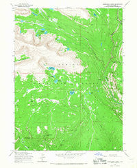
~ Rasmussen Lakes UT topo map, 1:24000 scale, 7.5 X 7.5 Minute, Historical, 1965, updated 1967
Rasmussen Lakes, Utah, USGS topographic map dated 1965.
Includes geographic coordinates (latitude and longitude). This topographic map is suitable for hiking, camping, and exploring, or framing it as a wall map.
Printed on-demand using high resolution imagery, on heavy weight and acid free paper, or alternatively on a variety of synthetic materials.
Topos available on paper, Waterproof, Poly, or Tyvek. Usually shipping rolled, unless combined with other folded maps in one order.
- Product Number: USGS-5460227
- Free digital map download (high-resolution, GeoPDF): Rasmussen Lakes, Utah (file size: 11 MB)
- Map Size: please refer to the dimensions of the GeoPDF map above
- Weight (paper map): ca. 55 grams
- Map Type: POD USGS Topographic Map
- Map Series: HTMC
- Map Verison: Historical
- Cell ID: 37079
- Scan ID: 251464
- Imprint Year: 1967
- Woodland Tint: Yes
- Aerial Photo Year: 1964
- Field Check Year: 1965
- Survey Year: 1955
- Datum: NAD27
- Map Projection: Polyconic
- Map published by United States Geological Survey
- Map Language: English
- Scanner Resolution: 600 dpi
- Map Cell Name: Rasmussen Lakes
- Grid size: 7.5 X 7.5 Minute
- Date on map: 1965
- Map Scale: 1:24000
- Geographical region: Utah, United States
Neighboring Maps:
All neighboring USGS topo maps are available for sale online at a variety of scales.
Spatial coverage:
Topo map Rasmussen Lakes, Utah, covers the geographical area associated the following places:
- Cirque Lake - Bennion Park - Pole Creek Lake - Big Bend Hollow - Goose Egg Peak - Island Lake Dam - Lower Rock Lake - Davis Park - West Fork Whiterocks River - Pot Holes - Pole Creek Campground - Big Bend - Johnson Creek - Frog Lake - Larvae Lake - Hidden Lake - Pole Creek Sink - Upper Rock Lake - Pole Mountain - Big Bend Hollow Spring - Cliff Creek - East Fork Whiterocks River - Ashley National Forest - Middle Rock Lake - Bull Elk Creek Spring - Island Lake - Little Basin - Lucky Spring - Point Lake - Rasmussen Lakes - Bennion Spring
- Map Area ID: AREA40.7540.625-110.125-110
- Northwest corner Lat/Long code: USGSNW40.75-110.125
- Northeast corner Lat/Long code: USGSNE40.75-110
- Southwest corner Lat/Long code: USGSSW40.625-110.125
- Southeast corner Lat/Long code: USGSSE40.625-110
- Northern map edge Latitude: 40.75
- Southern map edge Latitude: 40.625
- Western map edge Longitude: -110.125
- Eastern map edge Longitude: -110


