
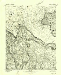
~ Notom 3 SW UT topo map, 1:24000 scale, 7.5 X 7.5 Minute, Historical, 1952, updated 1954
Notom 3 SW, Utah, USGS topographic map dated 1952.
Includes geographic coordinates (latitude and longitude). This topographic map is suitable for hiking, camping, and exploring, or framing it as a wall map.
Printed on-demand using high resolution imagery, on heavy weight and acid free paper, or alternatively on a variety of synthetic materials.
Topos available on paper, Waterproof, Poly, or Tyvek. Usually shipping rolled, unless combined with other folded maps in one order.
- Product Number: USGS-5459647
- Free digital map download (high-resolution, GeoPDF): Notom 3 SW, Utah (file size: 12 MB)
- Map Size: please refer to the dimensions of the GeoPDF map above
- Weight (paper map): ca. 55 grams
- Map Type: POD USGS Topographic Map
- Map Series: HTMC
- Map Verison: Historical
- Cell ID: 11729
- Scan ID: 251039
- Imprint Year: 1954
- Aerial Photo Year: 1951
- Datum: Unstated
- Map Projection: Unstated
- Preliminary map: Yes
- Map published by United States Geological Survey
- Keywords: Nonstandard Press Run
- Map Language: English
- Scanner Resolution: 600 dpi
- Map Cell Name: Deer Creek Lake
- Grid size: 7.5 X 7.5 Minute
- Date on map: 1952
- Map Scale: 1:24000
- Geographical region: Utah, United States
Neighboring Maps:
All neighboring USGS topo maps are available for sale online at a variety of scales.
Spatial coverage:
Topo map Notom 3 SW, Utah, covers the geographical area associated the following places:
- Circle Lake - Moosman Reservoir - Deer Creek Lake - Deer Lakes - Mima Lake - Cresecent Lake - West Fork Boulder Creek - Meeks Lake - Baker Lake - Divide Lake - Long Draw - The Baldys - Dry Creek - Big Lake - Kings Pasture - East Boulder Draw - Lake Draw - Trail Point - Sawmill Point - Pleasant Lake - Horseshoe Lake - Crater Lake - East Fork Boulder Creek - Pleasant Creek Meadow - Chriss Lake - East Lake - Durfey Creek - Boulder Meadows - Grass Lake - Sawmill - Green Lake - Ledge Lake - Oak Draw - Stink Draw - Moosman Draw - West Fork Reservoir - Noon Lake - East Boulder Lakes - Gresham Spring - Meeks Draw - Baker Pasture - Kings Pasture Reservoir - Halfmoon Lake - Rain Lakes
- Map Area ID: AREA38.12538-111.5-111.375
- Northwest corner Lat/Long code: USGSNW38.125-111.5
- Northeast corner Lat/Long code: USGSNE38.125-111.375
- Southwest corner Lat/Long code: USGSSW38-111.5
- Southeast corner Lat/Long code: USGSSE38-111.375
- Northern map edge Latitude: 38.125
- Southern map edge Latitude: 38
- Western map edge Longitude: -111.5
- Eastern map edge Longitude: -111.375


