
~ Mt Catherine UT topo map, 1:24000 scale, 7.5 X 7.5 Minute, Historical, 1961, updated 1977
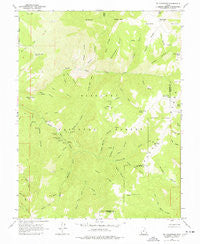
Mt Catherine, Utah, USGS topographic map dated 1961.
Includes geographic coordinates (latitude and longitude). This topographic map is suitable for hiking, camping, and exploring, or framing it as a wall map.
Printed on-demand using high resolution imagery, on heavy weight and acid free paper, or alternatively on a variety of synthetic materials.
Topos available on paper, Waterproof, Poly, or Tyvek. Usually shipping rolled, unless combined with other folded maps in one order.
- Product Number: USGS-5459391
- Free digital map download (high-resolution, GeoPDF): Mt Catherine, Utah (file size: 12 MB)
- Map Size: please refer to the dimensions of the GeoPDF map above
- Weight (paper map): ca. 55 grams
- Map Type: POD USGS Topographic Map
- Map Series: HTMC
- Map Verison: Historical
- Cell ID: 30526
- Scan ID: 250846
- Imprint Year: 1977
- Woodland Tint: Yes
- Aerial Photo Year: 1956
- Field Check Year: 1961
- Datum: NAD27
- Map Projection: Polyconic
- Map published by United States Geological Survey
- Map Language: English
- Scanner Resolution: 600 dpi
- Map Cell Name: Mount Catherine
- Grid size: 7.5 X 7.5 Minute
- Date on map: 1961
- Map Scale: 1:24000
- Geographical region: Utah, United States
Neighboring Maps:
All neighboring USGS topo maps are available for sale online at a variety of scales.
Spatial coverage:
Topo map Mt Catherine, Utah, covers the geographical area associated the following places:
- Cottonwood Canyon - Three Forks - The Lakes - Number Two Spring - Burned Point Canyon - Turner Timber Spring - Jacks Peak - Hardscrabble Canyon - Snow Canyon - Mountain Sheep Canyon - Broad Canyon - Paradise Creek - Rocky Canyon - Buck Hollow - Cottonwood Spring - Sims Canyon - Copley Creek - Balsam Picnic Area - Lost Canyon - Lone Pine Spring - Pistol Rock Picnic Area - Flat Canyon - Indian Springs - Pioneer Peak - Shingle Mill Spring - Balsam Spring - Rock Canyon - Fall Canyon - Lone Pine Canyon - White Pine Creek - Turner Wash - Number Three Spring - Water Canyon - Copleys Cove Picnic Area - Mason Gulch - Bear Hollow Spring - Willow Creek Peak - Reece Canyon - Bear Hollow - Cedar Springs Canyon - Magpie Canyon - Jacks Twist - Buckskin Charley Picnic Area - Chokecherry Creek - Shingle Mill Picnic Area - Copley Canyon - Black Cedar Hills Spring - Horse Hollow - Solitude Guard Station - White Sage Flat - Deer Canyon - Paradise Canyon - Teeples Ridge - Shingle Mill Canyon - Teeples Spring - Hans Ridge - Indian Springs Guard Station - Blue Ridge - Teeples Wash - Sugarloaf Mountain - Bear Canyon - Nephi Canyon - Mount Catherine
- Map Area ID: AREA3938.875-112.25-112.125
- Northwest corner Lat/Long code: USGSNW39-112.25
- Northeast corner Lat/Long code: USGSNE39-112.125
- Southwest corner Lat/Long code: USGSSW38.875-112.25
- Southeast corner Lat/Long code: USGSSE38.875-112.125
- Northern map edge Latitude: 39
- Southern map edge Latitude: 38.875
- Western map edge Longitude: -112.25
- Eastern map edge Longitude: -112.125


