
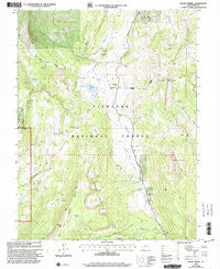
~ Mount Terrill UT topo map, 1:24000 scale, 7.5 X 7.5 Minute, Historical, 2001, updated 2003
Mount Terrill, Utah, USGS topographic map dated 2001.
Includes geographic coordinates (latitude and longitude). This topographic map is suitable for hiking, camping, and exploring, or framing it as a wall map.
Printed on-demand using high resolution imagery, on heavy weight and acid free paper, or alternatively on a variety of synthetic materials.
Topos available on paper, Waterproof, Poly, or Tyvek. Usually shipping rolled, unless combined with other folded maps in one order.
- Product Number: USGS-5459295
- Free digital map download (high-resolution, GeoPDF): Mount Terrill, Utah (file size: 15 MB)
- Map Size: please refer to the dimensions of the GeoPDF map above
- Weight (paper map): ca. 55 grams
- Map Type: POD USGS Topographic Map
- Map Series: HTMC
- Map Verison: Historical
- Cell ID: 30839
- Scan ID: 250781
- Imprint Year: 2003
- Woodland Tint: Yes
- Aerial Photo Year: 1997
- Edit Year: 2001
- Datum: NAD27
- Map Projection: Lambert Conformal Conic
- Map published by United States Geological Survey
- Map published by United States Forest Service
- Map Language: English
- Scanner Resolution: 600 dpi
- Map Cell Name: Mount Terrill
- Grid size: 7.5 X 7.5 Minute
- Date on map: 2001
- Map Scale: 1:24000
- Geographical region: Utah, United States
Neighboring Maps:
All neighboring USGS topo maps are available for sale online at a variety of scales.
Spatial coverage:
Topo map Mount Terrill, Utah, covers the geographical area associated the following places:
- Gottfredsen Creek - Tasha Creek - Mount Marvine - Butterfield Meadow - Daniels Pass - U M Pass - Sevenmile Cirques - Lake Louise - Sanford Spring - Humphrey Spring - Richfield Division - Petes Hole - Cold Spring - Sawmill Creek - Lost Creek Dam - Mount Terrill Guard Station - Bronco Spring - Neals Flat - White Creek - Broadhead Lakes - Lost Creek Reservoir - Snow Lake - Travois Spring - Mount Terrill - Spirit Spring - Whiskey Knoll - Horse Bench - Boobe Hole Mountain
- Map Area ID: AREA38.7538.625-111.75-111.625
- Northwest corner Lat/Long code: USGSNW38.75-111.75
- Northeast corner Lat/Long code: USGSNE38.75-111.625
- Southwest corner Lat/Long code: USGSSW38.625-111.75
- Southeast corner Lat/Long code: USGSSE38.625-111.625
- Northern map edge Latitude: 38.75
- Southern map edge Latitude: 38.625
- Western map edge Longitude: -111.75
- Eastern map edge Longitude: -111.625


