
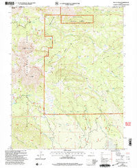
~ Mount Peale UT topo map, 1:24000 scale, 7.5 X 7.5 Minute, Historical, 2001, updated 2004
Mount Peale, Utah, USGS topographic map dated 2001.
Includes geographic coordinates (latitude and longitude). This topographic map is suitable for hiking, camping, and exploring, or framing it as a wall map.
Printed on-demand using high resolution imagery, on heavy weight and acid free paper, or alternatively on a variety of synthetic materials.
Topos available on paper, Waterproof, Poly, or Tyvek. Usually shipping rolled, unless combined with other folded maps in one order.
- Product Number: USGS-5459267
- Free digital map download (high-resolution, GeoPDF): Mount Peale, Utah (file size: 13 MB)
- Map Size: please refer to the dimensions of the GeoPDF map above
- Weight (paper map): ca. 55 grams
- Map Type: POD USGS Topographic Map
- Map Series: HTMC
- Map Verison: Historical
- Cell ID: 30746
- Scan ID: 250764
- Imprint Year: 2004
- Woodland Tint: Yes
- Aerial Photo Year: 1997
- Edit Year: 2001
- Datum: NAD27
- Map Projection: Lambert Conformal Conic
- Map published by United States Geological Survey
- Map published by United States Forest Service
- Map Language: English
- Scanner Resolution: 600 dpi
- Map Cell Name: Mount Peale
- Grid size: 7.5 X 7.5 Minute
- Date on map: 2001
- Map Scale: 1:24000
- Geographical region: Utah, United States
Neighboring Maps:
All neighboring USGS topo maps are available for sale online at a variety of scales.
Spatial coverage:
Topo map Mount Peale, Utah, covers the geographical area associated the following places:
- Mount Mellenthin - Canopy Spring - South Fork Beaver Creek - Beaver Lake - Dark Canyon Lake - Haystack Mountain - Blue Lake - La Sal Mountains - Medicine Lakes - Mount Peale - Geyser Pass - Canopy Gap - Dark Canyon
- Map Area ID: AREA38.538.375-109.25-109.125
- Northwest corner Lat/Long code: USGSNW38.5-109.25
- Northeast corner Lat/Long code: USGSNE38.5-109.125
- Southwest corner Lat/Long code: USGSSW38.375-109.25
- Southeast corner Lat/Long code: USGSSE38.375-109.125
- Northern map edge Latitude: 38.5
- Southern map edge Latitude: 38.375
- Western map edge Longitude: -109.25
- Eastern map edge Longitude: -109.125


