
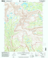
~ Mount Emmons UT topo map, 1:24000 scale, 7.5 X 7.5 Minute, Historical, 1996, updated 2000
Mount Emmons, Utah, USGS topographic map dated 1996.
Includes geographic coordinates (latitude and longitude). This topographic map is suitable for hiking, camping, and exploring, or framing it as a wall map.
Printed on-demand using high resolution imagery, on heavy weight and acid free paper, or alternatively on a variety of synthetic materials.
Topos available on paper, Waterproof, Poly, or Tyvek. Usually shipping rolled, unless combined with other folded maps in one order.
- Product Number: USGS-5459239
- Free digital map download (high-resolution, GeoPDF): Mount Emmons, Utah (file size: 14 MB)
- Map Size: please refer to the dimensions of the GeoPDF map above
- Weight (paper map): ca. 55 grams
- Map Type: POD USGS Topographic Map
- Map Series: HTMC
- Map Verison: Historical
- Cell ID: 30575
- Scan ID: 250746
- Imprint Year: 2000
- Woodland Tint: Yes
- Aerial Photo Year: 1993
- Edit Year: 1996
- Datum: NAD27
- Map Projection: Lambert Conformal Conic
- Map published by United States Geological Survey
- Map published by United States Forest Service
- Map Language: English
- Scanner Resolution: 600 dpi
- Map Cell Name: Mount Emmons
- Grid size: 7.5 X 7.5 Minute
- Date on map: 1996
- Map Scale: 1:24000
- Geographical region: Utah, United States
Neighboring Maps:
All neighboring USGS topo maps are available for sale online at a variety of scales.
Spatial coverage:
Topo map Mount Emmons, Utah, covers the geographical area associated the following places:
- West Timothy Lake - Lily Pad Lakes - Oke Doke Lake - B-29 Lake - Lower Carroll Lake - East Carroll Lake - Upper Chain Lake Dam - Fourth Chain Lake - Jackson Park - Roberts Lake - Krebs Basin - East Timothy Lake - Allred Lake - Roberts Pass - Lake Atwood Dam - Lake Atwood - Upper Carroll Lake - Middle Chain Lake - Mount Emmons - Deer Lake - Allen Lake - Grayling Lake - Timothy Lakes - Upper Chain Lake - Center Timothy Lake - Carrol Lake - Chain Lakes - East Timothy Dam - Owl Creek - Deer Lake Dam - Krebs Lake - Buffalo Creek - White Miller Lake
- Map Area ID: AREA40.7540.625-110.375-110.25
- Northwest corner Lat/Long code: USGSNW40.75-110.375
- Northeast corner Lat/Long code: USGSNE40.75-110.25
- Southwest corner Lat/Long code: USGSSW40.625-110.375
- Southeast corner Lat/Long code: USGSSE40.625-110.25
- Northern map edge Latitude: 40.75
- Southern map edge Latitude: 40.625
- Western map edge Longitude: -110.375
- Eastern map edge Longitude: -110.25


