
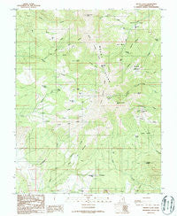
~ Mount Ellen UT topo map, 1:24000 scale, 7.5 X 7.5 Minute, Historical, 1986, updated 1987
Mount Ellen, Utah, USGS topographic map dated 1986.
Includes geographic coordinates (latitude and longitude). This topographic map is suitable for hiking, camping, and exploring, or framing it as a wall map.
Printed on-demand using high resolution imagery, on heavy weight and acid free paper, or alternatively on a variety of synthetic materials.
Topos available on paper, Waterproof, Poly, or Tyvek. Usually shipping rolled, unless combined with other folded maps in one order.
- Product Number: USGS-5459227
- Free digital map download (high-resolution, GeoPDF): Mount Ellen, Utah (file size: 14 MB)
- Map Size: please refer to the dimensions of the GeoPDF map above
- Weight (paper map): ca. 55 grams
- Map Type: POD USGS Topographic Map
- Map Series: HTMC
- Map Verison: Historical
- Cell ID: 30569
- Scan ID: 250739
- Imprint Year: 1987
- Woodland Tint: Yes
- Aerial Photo Year: 1981
- Edit Year: 1986
- Field Check Year: 1984
- Datum: NAD27
- Map Projection: Polyconic
- Provisional map: Yes
- Map published by United States Geological Survey
- Map Language: English
- Scanner Resolution: 600 dpi
- Map Cell Name: Mount Ellen
- Grid size: 7.5 X 7.5 Minute
- Date on map: 1986
- Map Scale: 1:24000
- Geographical region: Utah, United States
Neighboring Maps:
All neighboring USGS topo maps are available for sale online at a variety of scales.
Spatial coverage:
Topo map Mount Ellen, Utah, covers the geographical area associated the following places:
- North Summit Ridge - Raggy Draws - Dark Canyon - Copper Ridge - Durfey Butte - Slate Flat - South Creek Ridge - Box Spring - Desert Overlook - Wickiup Ridge - Head of Bullfrog - Corral Point - Bull Creek Pass - Blue Basin - Pistol Ridge - Star Flat - Willow Spring - Ragged Mountain - South Fork Pistol Creek - Nasty Flat - Copper Basin - McClellan Spring - Mount Ellen - Dandelion Flat - Dry Lake Flat - Airplane Spring - Mount Ellen Creek - Pennellen Pass - Bromide Canyon - North Fork Pistol Creek - Lonesome Beaver Campground - Willow Creek - Bromide Mine - Garden Basin - Copper Basin Spring - Bartons Peak - Pearl Flat - South Summit Ridge - Kimble and Turner Peak - Granite Hole - North Fork South Creek - Pistol Creek - Bromide Basin - Sawmill Basin - McMillan Springs Campground - Birch Spring - Wickiup Pass - Burned Ridge - Granite Ridges - Log Flat - Mount Ellen Peak
- Map Area ID: AREA38.12538-110.875-110.75
- Northwest corner Lat/Long code: USGSNW38.125-110.875
- Northeast corner Lat/Long code: USGSNE38.125-110.75
- Southwest corner Lat/Long code: USGSSW38-110.875
- Southeast corner Lat/Long code: USGSSE38-110.75
- Northern map edge Latitude: 38.125
- Southern map edge Latitude: 38
- Western map edge Longitude: -110.875
- Eastern map edge Longitude: -110.75


