
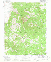
~ Monroe Peak UT topo map, 1:24000 scale, 7.5 X 7.5 Minute, Historical, 1980, updated 1981
Monroe Peak, Utah, USGS topographic map dated 1980.
Includes geographic coordinates (latitude and longitude). This topographic map is suitable for hiking, camping, and exploring, or framing it as a wall map.
Printed on-demand using high resolution imagery, on heavy weight and acid free paper, or alternatively on a variety of synthetic materials.
Topos available on paper, Waterproof, Poly, or Tyvek. Usually shipping rolled, unless combined with other folded maps in one order.
- Product Number: USGS-5459113
- Free digital map download (high-resolution, GeoPDF): Monroe Peak, Utah (file size: 14 MB)
- Map Size: please refer to the dimensions of the GeoPDF map above
- Weight (paper map): ca. 55 grams
- Map Type: POD USGS Topographic Map
- Map Series: HTMC
- Map Verison: Historical
- Cell ID: 29883
- Scan ID: 250648
- Imprint Year: 1981
- Woodland Tint: Yes
- Aerial Photo Year: 1973
- Edit Year: 1980
- Field Check Year: 1975
- Datum: NAD27
- Map Projection: Lambert Conformal Conic
- Map published by United States Geological Survey
- Map Language: English
- Scanner Resolution: 600 dpi
- Map Cell Name: Monroe Peak
- Grid size: 7.5 X 7.5 Minute
- Date on map: 1980
- Map Scale: 1:24000
- Geographical region: Utah, United States
Neighboring Maps:
All neighboring USGS topo maps are available for sale online at a variety of scales.
Spatial coverage:
Topo map Monroe Peak, Utah, covers the geographical area associated the following places:
- Sage Flat - Monkey Flat Ridge - Brindley Flat - Scrub Flat Reservoir - South Fork Monroe Creek - South Bend Canal - Monroe Meadows - Shingle Creek - City of Monroe - Koosharem Guard Station Scrub Flat Trail - The Gates - Bertlesen Ditch - Serviceberry Trail - Mud Spring Flat - Glenwood Mountain - Third Lefthand Fork Trail - Hunts Lakes - Devils Dutch Oven - Fitzgeral Park - The Gates - Sevier County Ambulance - Monore - Oak Flat Creek - Jackass Flat - Nielsen Canyon - Oak Flat - Eagle Flat - Reservoir Creek - Mud Lake - Bagley Meadows - Third Lefthand Fork - Monrovian Park - Oscars Vision - The Sinks - Hot Springs - Doxford Creek - Corner Spring Canyon - Lower Hunts Lake - Jackass Creek - Mud Spring - Monrovian Park Campground - Washburn Reservoir - Second Lefthand Fork Trail - Second Lefthand Fork - Sawmill Flat - Monkey Fork Dry Canyon - Monroe Creek - First Lefthand Fork - Scrub Flat - Serviceberry Creek - Sawmill Spring - Bertlesen Canyon - Monroe Peak
- Map Area ID: AREA38.62538.5-112.125-112
- Northwest corner Lat/Long code: USGSNW38.625-112.125
- Northeast corner Lat/Long code: USGSNE38.625-112
- Southwest corner Lat/Long code: USGSSW38.5-112.125
- Southeast corner Lat/Long code: USGSSE38.5-112
- Northern map edge Latitude: 38.625
- Southern map edge Latitude: 38.5
- Western map edge Longitude: -112.125
- Eastern map edge Longitude: -112


