
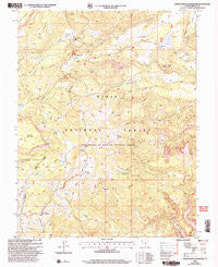
~ Lower Bowns Reservoir UT topo map, 1:24000 scale, 7.5 X 7.5 Minute, Historical, 2002, updated 2005
Lower Bowns Reservoir, Utah, USGS topographic map dated 2002.
Includes geographic coordinates (latitude and longitude). This topographic map is suitable for hiking, camping, and exploring, or framing it as a wall map.
Printed on-demand using high resolution imagery, on heavy weight and acid free paper, or alternatively on a variety of synthetic materials.
Topos available on paper, Waterproof, Poly, or Tyvek. Usually shipping rolled, unless combined with other folded maps in one order.
- Product Number: USGS-5458729
- Free digital map download (high-resolution, GeoPDF): Lower Bowns Reservoir, Utah (file size: 13 MB)
- Map Size: please refer to the dimensions of the GeoPDF map above
- Weight (paper map): ca. 55 grams
- Map Type: POD USGS Topographic Map
- Map Series: HTMC
- Map Verison: Historical
- Cell ID: 26788
- Scan ID: 250379
- Imprint Year: 2005
- Woodland Tint: Yes
- Aerial Photo Year: 1998
- Edit Year: 2002
- Datum: NAD27
- Map Projection: Lambert Conformal Conic
- Map published by United States Geological Survey
- Map published by United States Forest Service
- Map Language: English
- Scanner Resolution: 600 dpi
- Map Cell Name: Lower Bowns Reservoir
- Grid size: 7.5 X 7.5 Minute
- Date on map: 2002
- Map Scale: 1:24000
- Geographical region: Utah, United States
Neighboring Maps:
All neighboring USGS topo maps are available for sale online at a variety of scales.
Spatial coverage:
Topo map Lower Bowns Reservoir, Utah, covers the geographical area associated the following places:
- Bowery Flat - Oak Creek Campground - Sawmill Bench - Long Lake - Wildcat Ranger Station - Wildcat Creek - Blue Grass - Oak Creek Reservoir - Aspen Spring - Park Ridge - Round Lake - Bear Flat - Pole Corral Draw - Oak Creek Dam - Bowns Point - Cons Hole - Behanin Creek - The Terrace - Point Lookout - Oak Creek Forest Camp - Roundup Flat - Dry Bench - Spruce Spring - Cons Knoll - Steep Creek Lake - Bowns Lake - Scout Lake - Lower Bowns Dam - Pine Creek Campground - Blue Grass Lake - Pleasant Creek Campground - Keller Knoll - Aspen Point - Lower Bown Campground - Bowns Reservoir - Dunfey Creek - Edmunds Hole - Jorgenson Flat - Wildcat Pasture - Lower Bowns Reservoir - Windmill Ridge - Sunflower Flat - Parks Pasture - Big Ridge
- Map Area ID: AREA38.12538-111.375-111.25
- Northwest corner Lat/Long code: USGSNW38.125-111.375
- Northeast corner Lat/Long code: USGSNE38.125-111.25
- Southwest corner Lat/Long code: USGSSW38-111.375
- Southeast corner Lat/Long code: USGSSE38-111.25
- Northern map edge Latitude: 38.125
- Southern map edge Latitude: 38
- Western map edge Longitude: -111.375
- Eastern map edge Longitude: -111.25


