
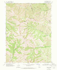
~ Lowe Peak UT topo map, 1:24000 scale, 7.5 X 7.5 Minute, Historical, 1968, updated 1971
Lowe Peak, Utah, USGS topographic map dated 1968.
Includes geographic coordinates (latitude and longitude). This topographic map is suitable for hiking, camping, and exploring, or framing it as a wall map.
Printed on-demand using high resolution imagery, on heavy weight and acid free paper, or alternatively on a variety of synthetic materials.
Topos available on paper, Waterproof, Poly, or Tyvek. Usually shipping rolled, unless combined with other folded maps in one order.
- Product Number: USGS-5458723
- Free digital map download (high-resolution, GeoPDF): Lowe Peak, Utah (file size: 15 MB)
- Map Size: please refer to the dimensions of the GeoPDF map above
- Weight (paper map): ca. 55 grams
- Map Type: POD USGS Topographic Map
- Map Series: HTMC
- Map Verison: Historical
- Cell ID: 26777
- Scan ID: 250376
- Imprint Year: 1971
- Woodland Tint: Yes
- Aerial Photo Year: 1966
- Field Check Year: 1968
- Datum: NAD27
- Map Projection: Polyconic
- Map published by United States Geological Survey
- Map Language: English
- Scanner Resolution: 600 dpi
- Map Cell Name: Lowe Peak
- Grid size: 7.5 X 7.5 Minute
- Date on map: 1968
- Map Scale: 1:24000
- Geographical region: Utah, United States
Neighboring Maps:
All neighboring USGS topo maps are available for sale online at a variety of scales.
Spatial coverage:
Topo map Lowe Peak, Utah, covers the geographical area associated the following places:
- Dead Ox Pass - The Jumpoff - Iron Spring - Lowe Spring - Lowe Peak - Bone Canyon - Rocky Peak - Pollywog Spring - White Pine Flat - Old Mayflower Mine - Big Hole - Queen Mine - Tie Fork - Left Hand Fork Soldier Canyon - Lowe Basin - Cottonwood Spring - South Fork Ophir Canyon - Right Hand Fork Soldier Canyon - Stockings Fork - Cottonwood Canyon - Jackson Hollow - Kelsey Peak - Chandler Fork - Mill Flat - Government Spring - Picnic Canyon - Piney Pass - Halls Basin - Bishop Fork - Rattlesnake Spring - Mill Canyon - Utah Metal Company Tunnel - Crooked Canyon - Left Hand Fork Butterfield Canyon - Bear Gulch - Fox Hollow - Lowe Canyon - Blackjack Gulch - Monkins Hollow - Iron Canyon - White Pine Canyon - Harkers Canyon - Maple Canyon - Cold Spring - Breccia Knob - Spring Gulch - Shingle Gulch - Tooele Fork - Farmers Flat - Oak Grove - Maple Flat - Rock Spring - Fourmile Spring - Serviceberry Canyon - Bald Knoll - Sheep Ridge - Butterfield Peaks
- Map Area ID: AREA40.540.375-112.25-112.125
- Northwest corner Lat/Long code: USGSNW40.5-112.25
- Northeast corner Lat/Long code: USGSNE40.5-112.125
- Southwest corner Lat/Long code: USGSSW40.375-112.25
- Southeast corner Lat/Long code: USGSSE40.375-112.125
- Northern map edge Latitude: 40.5
- Southern map edge Latitude: 40.375
- Western map edge Longitude: -112.25
- Eastern map edge Longitude: -112.125


