
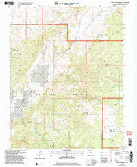
~ Little Creek Peak UT topo map, 1:24000 scale, 7.5 X 7.5 Minute, Historical, 2002, updated 2005
Little Creek Peak, Utah, USGS topographic map dated 2002.
Includes geographic coordinates (latitude and longitude). This topographic map is suitable for hiking, camping, and exploring, or framing it as a wall map.
Printed on-demand using high resolution imagery, on heavy weight and acid free paper, or alternatively on a variety of synthetic materials.
Topos available on paper, Waterproof, Poly, or Tyvek. Usually shipping rolled, unless combined with other folded maps in one order.
- Product Number: USGS-5458639
- Free digital map download (high-resolution, GeoPDF): Little Creek Peak, Utah (file size: 13 MB)
- Map Size: please refer to the dimensions of the GeoPDF map above
- Weight (paper map): ca. 55 grams
- Map Type: POD USGS Topographic Map
- Map Series: HTMC
- Map Verison: Historical
- Cell ID: 25947
- Scan ID: 250308
- Imprint Year: 2005
- Woodland Tint: Yes
- Aerial Photo Year: 1998
- Edit Year: 2002
- Datum: NAD27
- Map Projection: Lambert Conformal Conic
- Map published by United States Geological Survey
- Map published by United States Forest Service
- Map Language: English
- Scanner Resolution: 600 dpi
- Map Cell Name: Little Creek Peak
- Grid size: 7.5 X 7.5 Minute
- Date on map: 2002
- Map Scale: 1:24000
- Geographical region: Utah, United States
Neighboring Maps:
All neighboring USGS topo maps are available for sale online at a variety of scales.
Spatial coverage:
Topo map Little Creek Peak, Utah, covers the geographical area associated the following places:
- Upper Bear Valley - South Oak Brush Canyon - Le Fevre Creek - West Swale - Grouse Peak - Little Valley - Wildcat Spring - Navajo Spring - Brush Spring - West Spring - South Spring - Watercress Spring - Three Creeks Spring - Bear Valley Guard Station - Middle Fork Threemile Creek - Holly Oak Spring - Ashton Canyon - Little Creek Peak - Middle Canyon - Birch Spring - Sandy Fields - Middle Fork Sandy Creek - Edward Spring - Chokecherry Spring - Wide Hollow Spring - Rock Quarry Spring - North Swale - Cold Spring - Lower Bear Valley - Blue Meadows - Ashton Draw - Warm Spring - Left Fork Sandy Creek - Peak Canyon - Sandy Peak
- Map Area ID: AREA3837.875-112.625-112.5
- Northwest corner Lat/Long code: USGSNW38-112.625
- Northeast corner Lat/Long code: USGSNE38-112.5
- Southwest corner Lat/Long code: USGSSW37.875-112.625
- Southeast corner Lat/Long code: USGSSE37.875-112.5
- Northern map edge Latitude: 38
- Southern map edge Latitude: 37.875
- Western map edge Longitude: -112.625
- Eastern map edge Longitude: -112.5


