
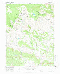
~ Lake Mountain UT topo map, 1:24000 scale, 7.5 X 7.5 Minute, Historical, 1965, updated 1984
Lake Mountain, Utah, USGS topographic map dated 1965.
Includes geographic coordinates (latitude and longitude). This topographic map is suitable for hiking, camping, and exploring, or framing it as a wall map.
Printed on-demand using high resolution imagery, on heavy weight and acid free paper, or alternatively on a variety of synthetic materials.
Topos available on paper, Waterproof, Poly, or Tyvek. Usually shipping rolled, unless combined with other folded maps in one order.
- Product Number: USGS-5458527
- Free digital map download (high-resolution, GeoPDF): Lake Mountain, Utah (file size: 11 MB)
- Map Size: please refer to the dimensions of the GeoPDF map above
- Weight (paper map): ca. 55 grams
- Map Type: POD USGS Topographic Map
- Map Series: HTMC
- Map Verison: Historical
- Cell ID: 24569
- Scan ID: 250240
- Imprint Year: 1984
- Woodland Tint: Yes
- Visual Version Number: 1
- Aerial Photo Year: 1962
- Field Check Year: 1965
- Datum: NAD27
- Map Projection: Polyconic
- Map published by United States Geological Survey
- Map published by United States Forest Service
- Map Language: English
- Scanner Resolution: 600 dpi
- Map Cell Name: Lake Mountain
- Grid size: 7.5 X 7.5 Minute
- Date on map: 1965
- Map Scale: 1:24000
- Geographical region: Utah, United States
Neighboring Maps:
All neighboring USGS topo maps are available for sale online at a variety of scales.
Spatial coverage:
Topo map Lake Mountain, Utah, covers the geographical area associated the following places:
- Mosby Sink - Gull Lake - Little Water Mines - Smelter Spring - Buckhorn Spring - Bills Spring - Lyles Hole Spring - Prospector Spring - Warden Spring - Canyon Spring - Sawtooth Ridge - Alcorn Hollow - Mosby Creek - Chalk Cliffs - Crow Creek - North Fork Crow Creek - Uranium Spring - Lake Canyon Spring - Chenab Spring - Chokecherry Flat Reservoir - Sage Hen Spring - Mill Canyon Spring - Indian Spring - Weasel Point - Knoll Spring - Lightning Spring - North Point Seep - Bum Spring - Little Water Hills - Bear Wallow Spring - Jay Point - Mule Hollow Spring - Deep Creek Spring - Corral Spring - Middle Mountain Seep - Lyman Spring - South Fork Dry Fork - Mosby Mountain Game Exclosure - Lower Flat Spring - Chicken Spring - Brownie Canyon - Middle Mountain - Cove Spring - Lower Flat Seep - North Fork Dry Fork - Walkup Spring - Bear Seep - Mill Canyon - Trail Canyon - Lake Mountain - Burton Reservoir - Beeler Spring - Cow Spring - Douglas Spring - Mosby Park - Lake Creek - Smelter Creek - Dryland Spring - Cedar Point Spring - Bills Park - Burton Seep - Lower Grouse Reservoir - Flat Spring - Squaw Spring - Grouse Creek - Sprouse Spring - Lower Bottom Spring - Grouse Flat Spring
- Map Area ID: AREA40.62540.5-109.875-109.75
- Northwest corner Lat/Long code: USGSNW40.625-109.875
- Northeast corner Lat/Long code: USGSNE40.625-109.75
- Southwest corner Lat/Long code: USGSSW40.5-109.875
- Southeast corner Lat/Long code: USGSSE40.5-109.75
- Northern map edge Latitude: 40.625
- Southern map edge Latitude: 40.5
- Western map edge Longitude: -109.875
- Eastern map edge Longitude: -109.75


