
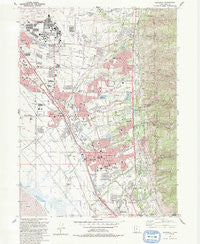
~ Kaysville UT topo map, 1:24000 scale, 7.5 X 7.5 Minute, Historical, 1992, updated 1992
Kaysville, Utah, USGS topographic map dated 1992.
Includes geographic coordinates (latitude and longitude). This topographic map is suitable for hiking, camping, and exploring, or framing it as a wall map.
Printed on-demand using high resolution imagery, on heavy weight and acid free paper, or alternatively on a variety of synthetic materials.
Topos available on paper, Waterproof, Poly, or Tyvek. Usually shipping rolled, unless combined with other folded maps in one order.
- Product Number: USGS-5458379
- Free digital map download (high-resolution, GeoPDF): Kaysville, Utah (file size: 14 MB)
- Map Size: please refer to the dimensions of the GeoPDF map above
- Weight (paper map): ca. 55 grams
- Map Type: POD USGS Topographic Map
- Map Series: HTMC
- Map Verison: Historical
- Cell ID: 23103
- Scan ID: 250122
- Imprint Year: 1992
- Woodland Tint: Yes
- Visual Version Number: 1
- Aerial Photo Year: 1986
- Edit Year: 1992
- Field Check Year: 1988
- Datum: NAD27
- Map Projection: Lambert Conformal Conic
- Map published by United States Geological Survey
- Map Language: English
- Scanner Resolution: 600 dpi
- Map Cell Name: Kaysville
- Grid size: 7.5 X 7.5 Minute
- Date on map: 1992
- Map Scale: 1:24000
- Geographical region: Utah, United States
Neighboring Maps:
All neighboring USGS topo maps are available for sale online at a variety of scales.
Spatial coverage:
Topo map Kaysville, Utah, covers the geographical area associated the following places:
- Island View Acres - Lakeland - Chapel Hill - Victorian Oaks - Morgan Farms - Twin Creek Estates - Lupine Village - Rolling Greens - Hidden Hideaway Condominium - Rogers Park - LaDonna Mesa - Camelot - Cherry View - Kaysville - Somerset Place Condominium - Quail Point - Jo Lu - Summer Haze - Colonies of East Pointe - Victory Park - Ruby Acres - Glendale Gardens - Barton Manor One - Holmes Creek Estates - Gailey - Snow Creek - Valley Hi - Nayon Heights Condominium - Whitesides Estates - West Kaysville - Marketboro - Fairfield Condominium - Roueche Hills - Farifield Park - Fairfield Farm Estates - Fruit Heights - East Crest Estates - Brook Haven - Lake Hills - Cook - Ellison - Aspen Heights - Phillips - Aura Acres - Rosewood - Meadows at Mutton Hollow Condominium - Leedot Heights - Mala - Royal Oaks - Tri Oaks - Oak Forest Two - Rolling Oaks - Foster-Grant - Barton Manor Three - East Layton - Diamond Hills - Spring Hollow - The Oaks at Mutton Hollow - Country Hollow - Hodson Estates - Oakmont Acres - Parkdale - Sundowner Condominium - The Orchard - Wheat Ridge - East Oaks - Country Estates - Gill - East Layton Hills - Brookhurst - Grand Oaks - Four Corners - Hill Villa - Layton Park Plaza Condominium - Robins Park One and Two - Johns Acres - Spurlock Circle - Natural Estates - Dimond Oaks - Pleasant Hills - Norager Acres - Misty Meadows - Hidden Hollow - Dreams End - Wooded Hills - Mountain View - Colonial Park - Country Oaks - Country Meadows - Heatherglen - Kaysville Heights - Holt - Jamestown - Cherry Farm Estates - Robinwood - Creek View Estates - Royal Farms Estates - Rosmait Park - West Layton - Kent Estates
- Map Area ID: AREA41.12541-112-111.875
- Northwest corner Lat/Long code: USGSNW41.125-112
- Northeast corner Lat/Long code: USGSNE41.125-111.875
- Southwest corner Lat/Long code: USGSSW41-112
- Southeast corner Lat/Long code: USGSSE41-111.875
- Northern map edge Latitude: 41.125
- Southern map edge Latitude: 41
- Western map edge Longitude: -112
- Eastern map edge Longitude: -111.875


