
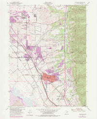
~ Kaysville UT topo map, 1:24000 scale, 7.5 X 7.5 Minute, Historical, 1955, updated 1985
Kaysville, Utah, USGS topographic map dated 1955.
Includes geographic coordinates (latitude and longitude). This topographic map is suitable for hiking, camping, and exploring, or framing it as a wall map.
Printed on-demand using high resolution imagery, on heavy weight and acid free paper, or alternatively on a variety of synthetic materials.
Topos available on paper, Waterproof, Poly, or Tyvek. Usually shipping rolled, unless combined with other folded maps in one order.
- Product Number: USGS-5458373
- Free digital map download (high-resolution, GeoPDF): Kaysville, Utah (file size: 12 MB)
- Map Size: please refer to the dimensions of the GeoPDF map above
- Weight (paper map): ca. 55 grams
- Map Type: POD USGS Topographic Map
- Map Series: HTMC
- Map Verison: Historical
- Cell ID: 23103
- Scan ID: 250119
- Imprint Year: 1985
- Woodland Tint: Yes
- Photo Revision Year: 1975
- Aerial Photo Year: 1975
- Field Check Year: 1955
- Survey Year: 1926
- Datum: NAD27
- Map Projection: Polyconic
- Map published by United States Geological Survey
- Map published by United States Army Corps of Engineers
- Map published by United States Army
- Map Language: English
- Scanner Resolution: 600 dpi
- Map Cell Name: Kaysville
- Grid size: 7.5 X 7.5 Minute
- Date on map: 1955
- Map Scale: 1:24000
- Geographical region: Utah, United States
Neighboring Maps:
All neighboring USGS topo maps are available for sale online at a variety of scales.
Spatial coverage:
Topo map Kaysville, Utah, covers the geographical area associated the following places:
- Jones - East Layton - Carrie Heights - Mutton Hollow Acres - Maple Acres - Walker - North Hills Estates - Barton Manor One - Green Oaks Estates - Summerfield - Kent Estates - Country Oaks - Victory Park - Spring Hollow - Village Green - Meadow Creek Condominium - East Meadow - Skyline Addition - Robinwood - Alta Acres - Cherry Farm Estates - Glendale Gardens - Church Hill Estates - Victorian Oaks - Aspen East - Kay Lyn Manor - Wheat Ridge - Ridge Crest Estates - Barker - Royal Oaks - Indian Oaks - Hill Villa - Oakridge Village Condominium - Oak Forest One - Phillips - Tamara Estates - Dawn Development - Hidden Hideaway Condominium - Hob Hill - Calder Hill - Johns Acres - Wasatch Heights - Palos Verde Estates - Quail Hollow - Green Leaf Meadows - Creek View Estates - Valley Hi - Brook Haven - Fort Lane - Farifield Park - Oakridge Terrace - Whitesides Estates - Park Heights - Church Street - Cherrywood - Chantilly Square - Hillside Estates - Mutton Hollow Meadows - Oakridge Farms - Cameron Estates - Morgan Farms - Snow Creek - Country Oaks Condominium - Eastview - Oak Hill - Lakewood - Holmes Hollow Estates - Park View Estates - East Oaks - Shanna - Avion Vista - Diamond Oaks - Rosmait Park - Creekside - Ellison - Kaysville - Country Lane - Pleasant Hills - Vera Lee - East Crest Estates - Spurlock Circle - Vallee Villa - Koziar Hills - Mount Dell - Brookhurst - Deer Run Estates - Mountain View - Heather Hills - Gill - Holmes Creek Estates - Dimond Oaks - Fairfield Farm Estates - Aspen Heights - Canyon Cove Estates - Marketboro Condostor Condominium - King Clarion Hills - Kens - Hods Hollow - Quail Creek - Hidden Hollow
- Map Area ID: AREA41.12541-112-111.875
- Northwest corner Lat/Long code: USGSNW41.125-112
- Northeast corner Lat/Long code: USGSNE41.125-111.875
- Southwest corner Lat/Long code: USGSSW41-112
- Southeast corner Lat/Long code: USGSSE41-111.875
- Northern map edge Latitude: 41.125
- Southern map edge Latitude: 41
- Western map edge Longitude: -112
- Eastern map edge Longitude: -111.875


